
A good investment
There is nothing worse than a great honking wide motorway (or in some cases a main rail line) severing a place in half disconnecting it from the wider environment. We have two classic examples of this with one in Grafton Gully and one in Manukau.
This is the Grafton Gully site (with the connecting park template superimposed):
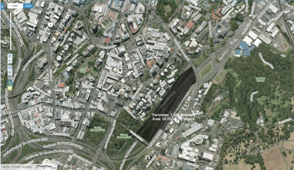
Source: Geo Maps Auckland Council
58,000m2 is 5.8 hectares.
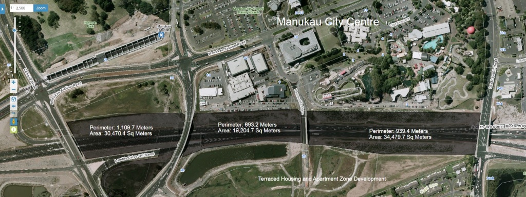
The Manukau severance:
The zoning for Manukau:
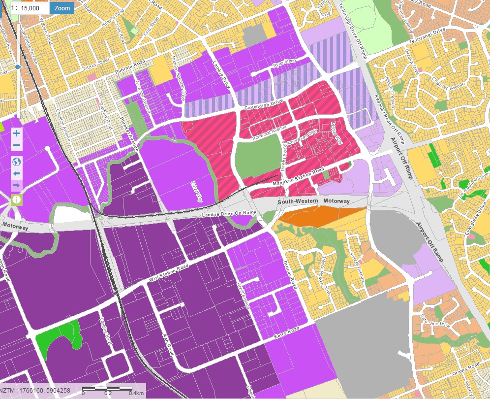
You have the Metropolitan Centre zoning for Manukau City Centre at the top and the Terraced Housing and Apartment Zone directly south of it on the other side of the motorway. In short some intense development inside the Transform Manukau area that is severed by a motorway.
Cue some stitching back up:
The 34,480m2 section I superimposed on State Highway 20 is 3.45 hectares of 8.52 acres, so not much bigger than the Dallas example.
But can you imagine the possibilities capping State Highway 20 at Manukau with an elevated parkland allowing connections between Manukau City Centre and the residential area to the south? Also imagine the noise being dampened down as well for the two areas.
The amenity from capping State Highway 20 at Manukau would be immeasurable in terms of extended green space, cycle paths, walking parks to a surrounding urban area that faces population growth pressures.
What do you think?
Should we cap the motorway for green space (the motorway will still be there)?

Source: Auckland Plan Implementation Update 2015

