The Unitary Plan Verses The Centralised Master Community Plan and the Semi-Liberal Plan District The last two posts on The Clunker (The Unitary Plan) and my … Continue reading The Unitary Plan, And the CMCP and SLPD’s

The Unitary Plan Verses The Centralised Master Community Plan and the Semi-Liberal Plan District The last two posts on The Clunker (The Unitary Plan) and my … Continue reading The Unitary Plan, And the CMCP and SLPD’s

Their Business Zoning and My Commercial and Industrial Zoning A Comparison March 28 I wrote a comparison post on The Clunker’s intended residential zones and my residential zones (from my … Continue reading The Clunker and Business Zones

Their Residential Zoning and My Residential Zoning A Comparison One of the biggest teeth gnashing happening with The Clunker (Unitary Plan) is the residential zoning being proposed that … Continue reading The Clunker and Residential Zoning
I have mentioned in the past that the Draft Unitary Plan was around 500 pages and it was larger than our largest Bible at home. Well it seems I got that number wrong as the Draft Unitary Plan actually stands at 1854 pages and takes Councillor George Wood two car trips to get the sole Council copy of this clunker to a public meeting.
1854 pages? What the flying heck Auckland Council, that is not a plan but just an actual dead weight to anyone and everything in the city. Maps aside, the idea was to get this clunker down to 100 A4 pages so that it was easy for everyone to read to access. Not just be a play thing for city planners and Environment Court Lawyers that costs us more money.
Bernard Orsman for the NZ Herald had this to say on the Clunker this morning:
Struggle to access copies of city plan
By Bernard Orsman @BernardOrsman
5:30 AM Thursday Mar 28, 2013
Navigating complex document online and finding a printed version proving difficult.
Many Aucklanders are struggling to find out if their neighbourhood is earmarked for high-rise apartments, heritage protection or the status quo in the new planning rulebook for the city.
The 1854-page draft unitary plan includes provisions for high-rise and multi-rise apartments and the nuts and bolts of what people can do with their properties.
But people are complaining about difficulty using the online version of the plan and trying to access 29 hard copies at local board offices, Auckland Town Hall and some libraries – about one copy for every 50,000 people.
At a public meeting in Mt Eden on Tuesday night, there was no material for locals to take away on the changes proposed for the suburb, only a single copy of maps to browse.
Birkenhead resident M. Carol Scott said in a letter to the Herald that she found the online document a “tortuously clunky process” and all she got from her local library was a brochure inviting her to “shape the world’s most liveable city”.
“Clearly, creating a Super City planning rulebook is a huge task, but how democratic is this process?” she said.
The Auckland Transport Blog said unlike the Auckland Plan – the 30-year blueprint for the city – the new rulebook was not a nicely worded document, but a complex, hard-to-use resource management document.…
You can read the rest over at the Herald
Personally I am not finding the e-document that easy to use and I regard myself as tech savvy. Even with Bookmarks applied in Chrome and until I saved the PDFs to my hard drive, it would take several attempts floundering around different parts of the Unitary Plan site to get to the two areas I am focusing on at the moment: The Rural Urban Boundary addendum, and the Zoning Rules in an effort to get them simplified even further. What is not helping is that you can read the PDF like the RUB material in question, but then you have five different maps showing “options” for the RUB rather than consolidating it as one PDF file. Thankfully I consolidated those maps into a single PDF and stuck it in Scribd last night – but heck that is annoying to do what the council should have done in the first place.
As a result in the Unitary Plan being a clunker and at over 1854 pages making it impossible to print – even if I did get the entire thing as a single PDF, getting a meaningful submission in is going to be an interesting task ahead.
However, I am off to the Papakura Local Board Unitary Plan session next month to see if I can make heads or tails of The Clunker before getting my submission in.
And now that I have that little rant off my chest this morning, my next Unitary Plan post will be on residential zoning. It’s Sim City meets Auckland Unitary Plan – here at BR:AKL
Shining The Light – To a Better Papakura (OUR home)
AND
To a Better Auckland – (OUR City)
Auckland 2013: YOUR CITY – YOUR CALL
I was at the Auckland Transport Board meeting today listening in on the Integrated Transport Program as well as (and mainly) any blood-letting from the latest patronage figures I alluded to earlier this week.
The AT Board did today however, did approve the $60 billion – 30 year Integrated Transport Program. In short the ITP brings together finally a single approach in dealing with all of Auckland‘s transport system from road to rail, car to train, cyclist to walker to ferry. The ITP also lists the amount of money needed – an eye watering $60 billion to maintain and renew existing transport assets while also investing in new transport assets as well. But as the ITP report states as embedded below; the funding is $15 billion short of the $60 billion needed. To make matters more interesting despite the investment via the ITP, Auckland will still be apparently worse off – go figure?
I’ll investigate this some more over Easter but for now happy reading
So the Unitary Plan is out for informal feedback from Auckland and we have central government sticking its nose in our affairs when it should learn to butt out. Commentary on the Unitary thus far has been rather weak on the actual issues at hand: the rules, the zones, the RUB, the infrastructure deficit which is eye watering, and how to deliver all this from (at this rate) September. Then again once our Deputy Mayor gets MP Nick Smith out of the city and tell him to butt out as he is being counter-productive attention might be drawn back to the rule book that affects the lives and businesses of Aucklanders.
As mentioned before I went away on holiday, commentary on the Unitary Plan will start as BR:AKL looks at the issues at hand. At the same time a series on an alternative to the Unitary Plan will run in parallel to Unitary Plan commentary. Today I am going to look at the Southern Rural Urban boundary where upwards of some 57,400 new Greenfield dwellings could end up depending on the option. This kind of Greenfield development stems from the Auckland Plan calling for 60% of urban development to happen in Brownfield land with the other 40% in new Greenfield land. The Southern Rural Urban Boundary (RUB) is one such spot (the others being in the North and North West of Auckland) where some of that 40% is meant to go.
For those wondering what a Rural Urban Boundary is, please check THIS LINK from the Unitary Plan on its description.
As for the Southern RUB there are three development options Auckland can take with this Greenfield Land (which is 15 minutes away from where I live by car). You can see all three options layered over a GIS Map and a GIS Map with an Issues and Constraints Overlay as well as each of the three options below in the embed below:
The two GIS maps (pages one and two) have dwelling capacity limits for each of the Greenfield zones depending on which option is taken.
Personally I am in favour of the Draft Southern RUB Options – Corridor Focus (Page 4 of the embed) which contains primary urban development to Drury and Karaka (Core’s K and D), along the State Highway 22 and North Island Main Trunk Line rail corridor, the North East Pukekohe flank, and the Pukekohe South East flank. This option keeps the main development either near existing development or along a transit corridor making infrastructure provisions (Drury and Paerata Rail Stations) and access more easier than the other options such as those that include Karaka North and West. Per The Unitary Plan there is an option to retain a green belt between Pukekohe and Paerata which would provide a wildlife corridor as well as park space. While development is kept away from the highly valuable Pahurehure Inlet which according to the maps contains colonies of wading sea birds. In any case that area slated as Karaka North and West if need be can be converted either into lifestyle blocks with strict covenants or over time into a new regional park and green lung for the ever-growing Auckland (which is what I would prefer Council would do (like an Ambury Farm or Puhinui Reserve set up)).
I have also noted as potential transport link from Whangapouri to Weymouth via a new bridge over the inlet as well as talk of a new waste water treatment plant. With me preferring the corridor option thus Karaka West and North not being developed – but actually wanting to be flipped over to lifestyle blocks or even better a regional reserve I can not see the need for a transit link through that area connecting to Weymouth. That link would create a rat-run from State Highway 20 at the Cavendish Drive Interchange, down Roscommon and Weymouth Roads (Route 17), over the new bridge, down the new transit link and through to State Highway 22 just north of Paerata rather than containing it to State Highways 1 and 22. That kind of rat running would lower the amenity of the new Greenfield developments and do nothing to solve congestion issues. As for the waste water treatment plant, well with Karaka North and West no longer under development you can away plop the new plant there out of the urban road but near the potential outfall site.
Submission wise I am going to follow through and “recommend” to Auckland Council that the Corridor Option for the RUB being the preferred southern Greenfield development options, providing there is:
I will keep tabs on this and see which way Council swings on this once the Unitary Plan becomes near operational – whenever that may be
Someone is going to like me for this
I am in Australia for two weeks and go into Manukau to conduct my business today and look what I see:
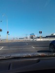
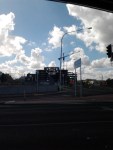
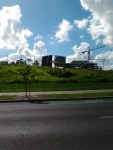
No movement what so ever in the construction of the MIT Building and AT Bus Interchange next to the Manukau Rail Station. It still looks like a shell and still looks dead with no activity.
There is a sign (that didn’t show up in the photo well) that does say MIT (and the bus interchange) will be open Mid-2013. I like to see this opening date still met with the site in its current form.
And as of last month, Auckland Transport were not aware of any delays of installing the gate line and ticket office down at Manukau. I might go check that out tomorrow and give an update to the Transport Committee.
So much for thinking work did resume on the project down at Manukau…

The Wheels on the Train go Round and – oh sod off… Auckland Transport must dread the last week of every month when they get round to releasing their … Continue reading So Where Next for Auckland Transport
Just in from Auckland Transport. I have just scoured the latest Auckland Transport Patronage Figures for ‘as-of’ February 2013 especially for rail.
There was a time two years ago when I was side by side with the mayor while working for Veolia Transport Auckland feeling proud and delighted with the Mayor that we had hit our 10 millionth rail passenger marking a new age for Auckland’s rail network. There was even cake and a photo of the occasion somewhere too.
However I read the latest rail patronage figures this evening released by AT at their website. You can see the figures in the embed below but I bring your attention to page ten of twenty-seven – the rail figures which stand at 9,996,066 today. A slippage from the 10,900,000 peak in August 2012 to now just under 10 million.
I wonder what AT will trot out on Wednesday at that meeting with now basically half the city alerted after the figures went around Twitter and Facebook…
And as Patrick Reynolds on Twitter said:
@BenRoss_AKL some crazy fare dodging going on because of generous gating and policing processes. #akrail
@pv_reynolds you said it not me. I gather fare dodging is at 16-28%
Panic stations any one?

Auckland Vs. Wellington Thanks to the kindness of Metro Magazine this thoughtful Editorial piece from Simon Wilson was able to be read while I was in Sydney and Brisbane … Continue reading Metro Mag Opinion
