
Seriously
Notice of Requirement Filled for the Storm Water Channel
We know the Council via the 2015-2025 Long Term Plan debate has laid out a set of 10 Spatial Priorities for the next 5-10 years. These Spatial Priorities I believe are focus areas for both urban development and supportive Council resources to support that urban development per the Unitary and Auckland Plans.
You can see the first looks of the Spatial Priorities below:


You can see that a large area around Papakura is slated for Spatial Priority work. You can also see a large tract of rural land between Papakura and Manurewa East (in green) slated for future Spatial Priority work after the first set of priorities is complete. The land in Papakura East and Takanini East (including Addison) is a large peat flood plain that has both urban and rural developments on them. The rural floodplain does flood often in heavy rain so if Council want to flip that land (which would be under the Unitary Plan Future Urban Zone) then drainage measures will need to be put in before Council allows urban development in that area.
The area being looked at in wider context
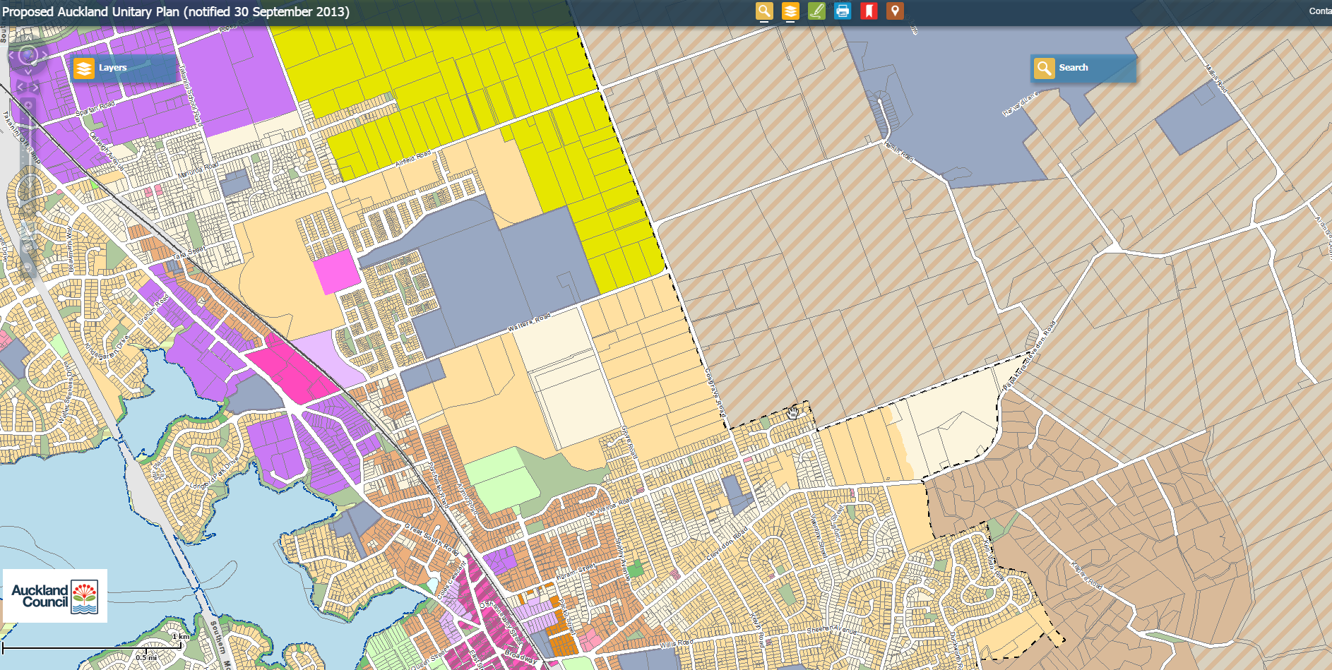
What we can see here is large tracts of rural land between Walters Road, Cosgrove Road established areas along Artillery Drive and Arimu Road being zoned Mixed Housing Suburban. Meaning post 2016 unless subject to a Special Housing Area or application under the pre 2016 legacy rules you can develop that rural land over into housing. Note: McLennan park is in that mix and will not be developed but kept as a park, sports ground and wetland.
So with the area prone to flooding Council are going to embark on a storm water channelling campaign. Cue a 2,100 metre open ditch.
Check out this Notice of Requirement (notification is on the 17th) and the Maps
The NoR
The maps of the areas affected by the ditch
Now to be perfectly honest and fair the Council are not just planning to build a storm water ditch like those seen on the North Shore. The Council if and when it goes ahead with this actual man-made stream (that will take storm water) will have the following features:

That is some pretty serious landscaping that would allow the channel area to become one big passive recreation open space in the middle of a suburban area. Something a heck of a lot better than the countless streams that run through urban Auckland that are poorly maintained and not rather friendly to both people and the wildlife in the area.
In answering the question would this be a first for New Zealand? I believe the answer would be yes. The Papamoa – Royal Palms Lake and stream that feeds into the ocean is there and was built during the development phase but, now the stream is covered in grass and does not have water in it unless it floods. So not really well done in the end.
If this can be pulled off and maintained by Council over 100 years the open channel and its landscaped flanked would be a valuable open space (and drainage) asset for the Takanini/Papakura area.
Lets see how this goes and whether submissions might force the more expensive option of putting the channel underground.


