The hidden logic behind the City’s Blue Print of Marsden Point
Wondered how your city and/or region works. Wondered what Planners do to enable (that is enable not disable) the ongoing evolution of your city and region that you live, work and play in? Does the Planner Word Salad get you absolutely lost? Don’t worry the word salad gets this planner lost too.
In any case I will be running a six part series using Marsden Point from Cities Skylines 2 to help decipher some of that planning word salad, what planners should be doing as economic enablers, while building a liveable city. The content will be a mix of words, infographics, slide decks, and videos. The content will be using the AI to summarise content drawn from Talking Southern Auckland, and Ben’s Cities blogs.
Part 1: 5 Surprising Truths About How Your City Works (Learned from a Video Game)
Introduction: The Hidden Logic of Your City
Have you ever been stuck in traffic and wondered why a particular road is always congested? Or perhaps you’ve seen a new high-rise building go up and questioned how that location was chosen, or who decides where the new bus or tram line should run. We experience the effects of these decisions every day, but the underlying logic that shapes our urban environment often remains invisible, a complex system of rules and relationships we rarely get to see.
Cities don’t just happen; they are designed. There is a hidden logic to their layout, their economic function, and their transportation networks. Uncovering this logic can want to try to solve an impossibly complex puzzle. But what if the key to understanding it came from an unexpected source?
One real-life urban planner is demystifying this process, using the sophisticated city-building game Cities: Skylines 2 as a virtual sandbox to model, test, and explain the core principles that govern modern urban development. By simulating everything from supply chains to public transit, they reveal the interconnected systems that make a city thrive or fail. Here are five of the most surprising and impactful truths about how your city works, learned from their virtual creations.
The City Blueprint: How are great cities born?
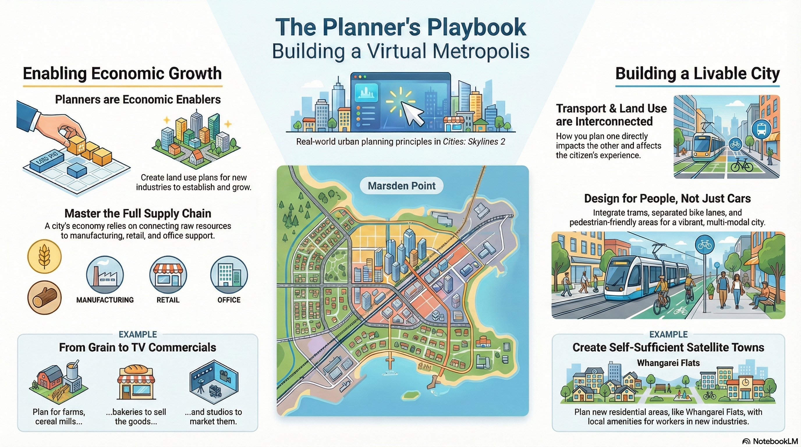
1. Planners Aren’t ‘Cereal Kings’—They’re the Architects of the Entire Supply Chain
Most people think urban planners just draw maps of streets and parks, but one of their first jobs is to ensure your city can feed itself. This surprising truth is illustrated perfectly by a concept the planner calls being the “City Cereal King.” While planners don’t own the factories, their work in land use planning is what enables the entire supply chain that puts food on your table.
As demonstrated in their virtual city of Marsden Point, the process begins long before a product hits the shelf. When the city’s economic development team sought to attract three specific new industries—Grain and Cereal, Livestock Processing, and Beverages—they turned to the planners. The planner’s job was not to zone new farmland, but to meticulously check the existing land use plans to confirm that the entire supply chain, from rural suppliers to the new industrial plants, could be supported within the region.
This reveals that urban planning is foundational to a city’s economic metabolism. A well-planned city doesn’t just have nice neighbourhoods; it has a functional economic engine, meticulously designed to support the flow of goods from the source to your home.
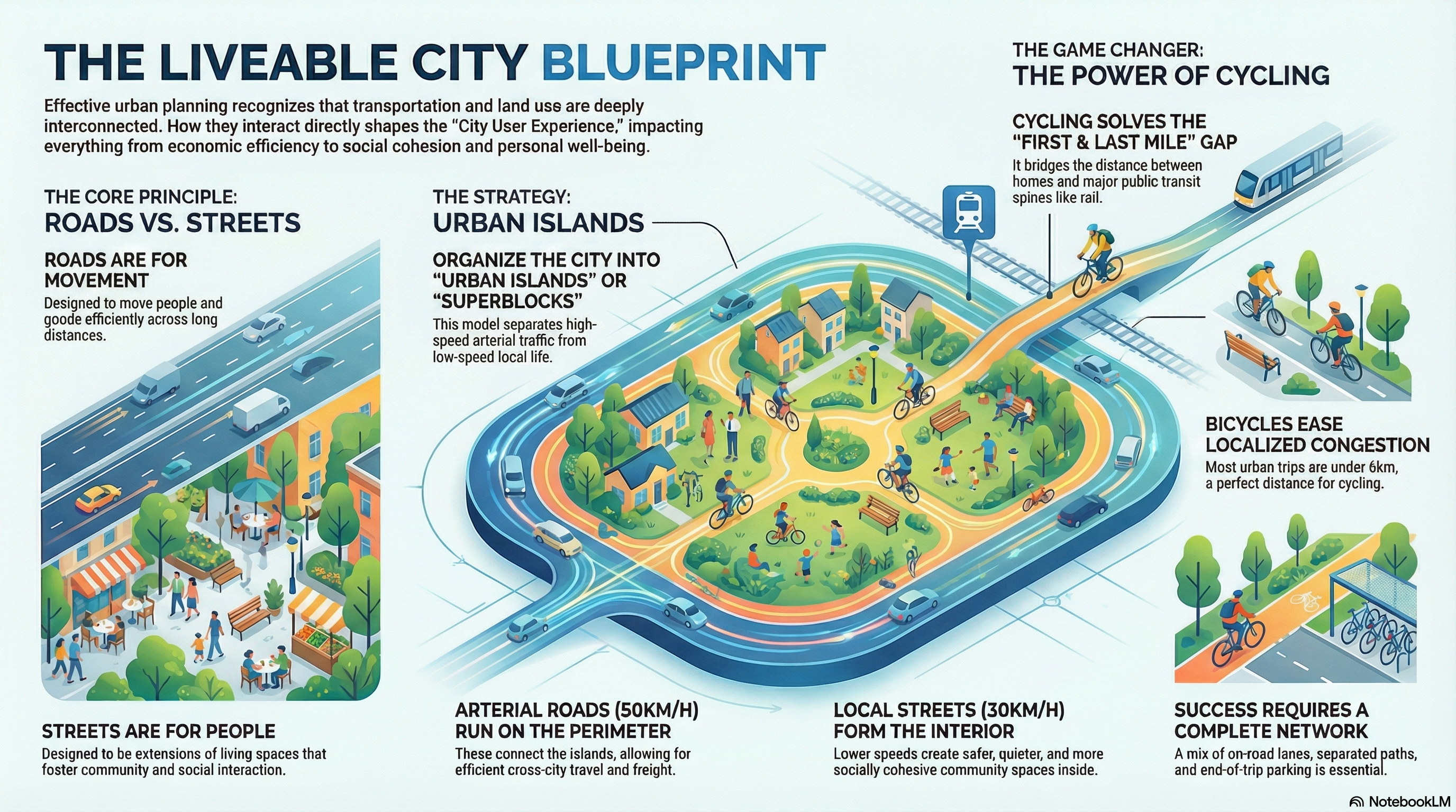
2. Great Transit and Great Neighbourhoods Are a Two-Way Street
What separates a vibrant, walkable city centre from a lifeless, car-choked sprawl? The answer lies in a powerful feedback loop, a principle the planner explicitly illustrates in a diagram titled “Transport affects Land Use, Land Use affects Transport, both affect the City User Experience.”
This concept is the conceptual backbone for the development of the virtual city of Marsden Point. By building extensive tram lines that run through dense city centres and along scenic waterfronts, the planner demonstrates this real-world principle in action. Investing in high-quality public transportation encourages denser, more people-focused development around it. In turn, these new homes, offices, and shops create a concentrated population of riders, which provides the demand and justification to sustain and expand the transit system.
The numerous screenshots of trams, bike lanes, and pedestrians filling the streets of Marsden Point are visual proof of this constructive collaboration. This relationship is a momentous change for urban design, offering a clear path away from car-dependent sprawl and toward the creation of more accessible, sustainable, and lively communities.
3. The Best Cities Are Built for People, Not Just Cars
For decades, urban design in many parts of the world prioritized the movement of automobiles more than anything else. The virtual city of Marsden Point displays a deliberate and forceful alternative. This represents a conscious rejection of the auto-centric dogma that dominated 20th-century urbanism, embracing a multi-modal approach where people come first.
The evidence is woven into the fabric of the city’s design. Wide, green, dedicated cycling lanes are a common feature on nearly every major street. Pedestrians are given ample space to walk, and public transport is robust, including trams, buses, and a metro system. Blog posts with titles like “Making Cycling Work for YOU and Your City” underscore that this is a core planning philosophy.
This in-game approach directly mirrors established best practices. The real-world Green Transit Corridors show how separated, protected lanes for bikes and buses can coexist with green space, while Mixed Use captures the vibrancy of a walkable commercial street where people, not cars, dominate. These are proven strategies for creating cities that are more enjoyable, equitable, and efficient for everyone.
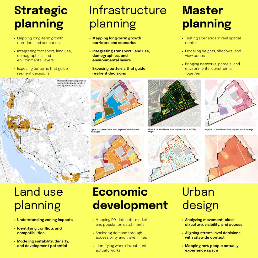
The different Planning fields Planners can work in to enable the evolution of either a city or region
4. A New Factory Isn’t Just a Building—It’s the Seed of a Whole New Community
When a major new employer comes to town, the economic benefit is obvious. But a planner sees something more: the need for an entire ecosystem to support it. The development of industrial plants at Marsden Point provides a perfect case study in this kind of holistic “Master Planning.”
The planner’s job didn’t end once the land was zoned for the new cereal, meat works, and beverage plants. The most critical step came next: planning for the people who would work there. The Master Plan’s second stage was the creation of “Whangarei Flats,” a satellite town designed specifically to provide housing and services for the workers. The plan also enabled secondary businesses to support the new industries, including a bakery, a sports bar, and even a television studio to market the locally produced goods.
This comprehensive approach is crucial for sustainable growth. As the planner notes, Whangarei Flats serves a similar function to a real-world town like Pukekohe, which supports the rural district of Franklin in Auckland. It recognizes that you can’t add jobs without also considering where people will live and how they will get to work. By planning the entire community at once, economic development strengthens the city rather than creating unfamiliar problems.
5. Virtual Worlds, Real Lessons: Video Games as the New Urban Sandbox
Perhaps the most surprising takeaway is not about cities themselves, but about how we can learn to understand them. The entire body of work from this “in-real-life Planner” demonstrates the incredible value of a sophisticated simulation like Cities: Skylines 2 as a tool for both professional exploration and public education.
By using the game to model real-world challenges in the city of Marsden Point—from implementing supply chains to retrofitting streets for cyclists—the planner makes complex urban geography and land use concepts tangible. It breaks down the barriers of technical jargon and abstract diagrams, allowing anyone to see the cause and effect of planning decisions play out in a dynamic, visual environment.
This transforms urban planning from a top-down, opaque process into a transparent, participatory dialogue about the kind of cities we want to inhabit. It allows professionals to evaluate ideas and helps citizens visualize the future of their communities, making the intricate world of urban planning more accessible than ever before.
Conclusion: Seeing Your City with New Eyes
The cities we live in are not random collections of buildings and roads. They are dynamic, interconnected systems, shaped by intentional decisions that balance economic needs, transportation planning, and human experience. By peering into a virtual world built on these real-life principles, we can begin to see the hidden logic that governs our own.
The next time you walk down your street, what hidden connections between transport, housing, and the local economy will you be able to see?