
So, can real world planning, and the mixed reality of virtual planning via Cities Skylines exist side by side?
Wondered how your city and/or region works. Wondered what Planners do to enable (that is enable not disable) the ongoing evolution of your city and region that you live, work and play in? Does the Planner Word Salad get you absolutely lost? Don’t worry the word salad gets this planner lost too.
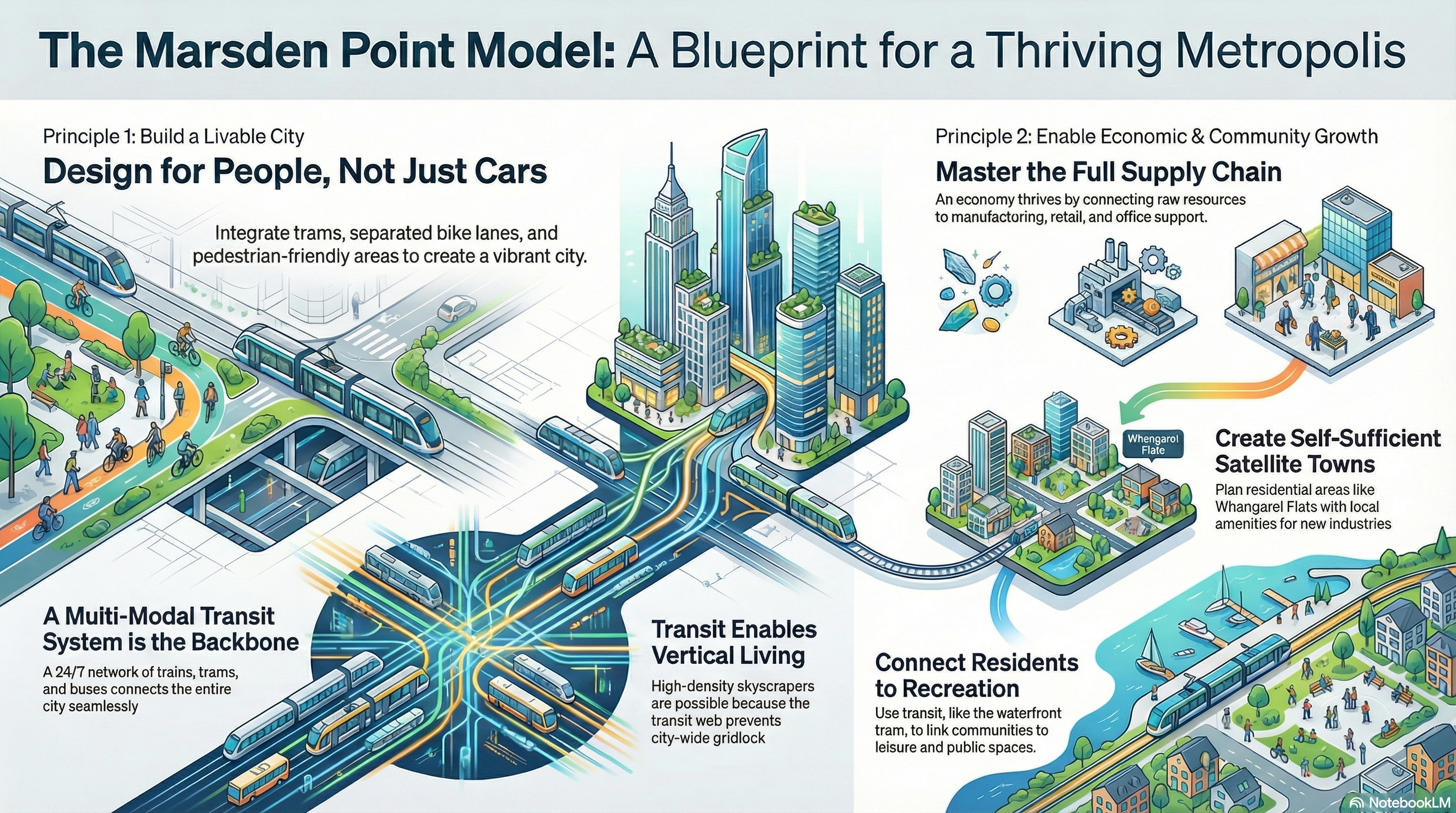
In any case I will be running a six part series using Marsden Point from Cities Skylines 2 to help decipher some of that planning word salad, what planners should be doing as economic enablers, while building a liveable city. Content will be a mix of words, infographics, slide decks, and videos. The content will be using the AI to summarise content drawn from Talking Southern Auckland, and Ben’s Cities blogs.
Part 4: State of Play between Digital Urban Simulator and Real World Planning by a Planner
As the Ben goes Planning series continues on, we come to that crossroad between real world planning, and virtual planning via Cities Skylines 2. So, how do the two blend to create a mixed reality, how does that mixed realty have the potential to inform real world planning? Real Planner, Virtual City takes a look at these questions.
For my review of where Cities Skylines 2 was at as of the end of 2025 you can read that review over at: State of Play: Does #CitiesSkylines2 hit the spot for this IRL Planner? (Ben’s Cities)
Marsden Point: A Planner’s Journey in Cities Skylines 2
I also have a Slide Deck that also covers how the mixed reality of Marsden Point assists in exploring real world urban planning principles. I also recap on my verdict of Cities Skylines as a digital sandbox.

