
No
It has been suggested that the Drury South industrial complex and surrounds (currently all Future Urban Zone land in the Unitary Plan) could be the next Manukau in terms of jobs and residents. The question could Drury be the next Manukau?
Well Drury (the short name I will give the industrial complex and surrounds which does include Auranga (Auranga Special Housing Area Gets Underway. 1,350 homes for the South)) is forecast to house upto 12,000 jobs (rivalling Wiri, the Airport and East Tamaki industrial complexes) and decent portion of the 55,000 new homes due in the Future Urban Zone areas across the Franklin and Papakura areas. Drury will be connected up by a new rail station (and electric trains running to Pukekohe), the Mill Road corridor and of course the Southern Motorway.

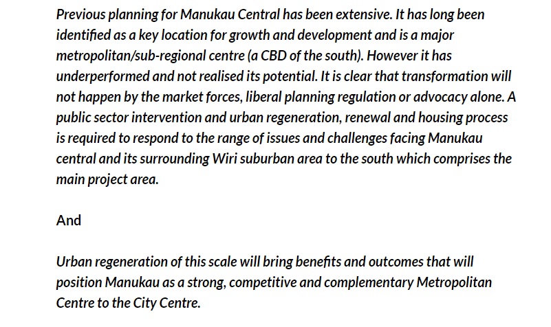
The Transform Manukau area under the stewardship of Panuku Development Auckland covers some 600 hectares and is forecast to house 20,000 people and equally as many jobs (if the full density is realised for the respective zones) with the surrounding Wiri industrial complex also continuing to expand in employment terms as well. Manukau as we know is connected by a rail line, soon a bus station, two motorways and several arterial roads.
So we can see some similarities between Manukau and the upcoming Drury but does that make Drury the next Manukau?
No.

Source: Auckland Plan Implementation Update 2015
Why?
To build a Centre like Manukau not only do you have the physical stuff but the people stuff too. Furthermore Manukau is listed as a Metropolitan Centre under the Auckland and Unitary Plans. I do not see Drury picking up a Metropolitan Centre (allows up to 18 storeys) spot unless it is moved from Papakura (thus Papakura subsequently is downgraded to a Town Centre). Drury will most likely pick up a Town Centre ranking (allowing up to eight storeys) as the area develops however, Town Centres are very different from Metropolitan Centres in terms of building type and social identities attached to them.
This is from the Unitary Plan on the two different Centre types:
H9. Business – Metropolitan Centre Zone
H9.1. Zone description
The Business – Metropolitan Centre Zone applies to centres located in different subregional catchments of Auckland. These centres are second only to the city centre in overall scale and intensity and act as focal points for community interaction and commercial growth and development and contain hubs serving high frequency transport.
The zone provides for a wide range of activities including commercial, leisure, high density residential, tourist, cultural, community and civic services. Zone provisions, in conjunction with rules in the other business zones, reinforce metropolitan centres as locations for all scales of commercial activity.
These centres are identified for growth and intensification. Expansion of these centres may be appropriate depending on strategic and local environmental considerations. Precincts and overlays that modify the underlying zone or have additional provisions apply to some of the metropolitan centres. Generally, however, to support an intense level of development, the zone allows for high-rise buildings.
Some street frontages within the zone are subject to Key Retail Frontage Control or General Commercial Frontage Control provisions as shown on the planning maps. Key retail streets are a focus of pedestrian activity within the centre. General commercial streets play a supporting role. Development fronting these streets is expected to reinforce this function. New vehicle crossings are generally to be avoided on site frontages subject to the Key Retail Frontage Control provisions and this is addressed in E27 Transport.
Buildings within the zone require resource consent to ensure that they are designed to a high standard, which enhance the quality of the centre’s streets and public open spaces.
……..
H10. Business – Town Centre Zone
H10.1. Zone description
The Business – Town Centre Zone applies to suburban centres throughout Auckland, the satellite centres of Warkworth and Pukekohe, and the rural towns of Helensville and Wellsford. The centres are typically located on main arterial roads, which provide good public transport access.
The zone provides for a wide range of activities including commercial, leisure, residential, tourist, cultural, community and civic services, providing a focus for commercial activities and growth. Most centres are identified for growth and intensification.
Expansion of these centres may be appropriate depending on strategic and local environmental considerations. There is a range of possible building heights depending on the context. Provisions typically enable buildings of between four and eight storeys, although there may be special circumstances where other building heights are appropriate.
The height opportunities within the centres will facilitate increased intensification, including office and residential activities at upper floors. Some street frontages within the zone are subject to a Key Retail Frontage Control or General Commercial Frontage Control provisions. Key retail streets are a focus for pedestrian activity within the centre. General commercial streets play a supporting role. Development fronting these streets is expected to reinforce this function.
…….
Source: http://unitaryplan.aucklandcouncil.govt.nz/pages/plan/Book.aspx?exhibit=ACDecision
What makes or breaks Drury to become a Metropolitan Centre (thus another Manukau) falls to the civic infrastructure and the identity people would place to it.
On the civic side; Manukau houses the courts, Police HQ (that spans into the Franklin District), Council services and offices for the entire Southern Auckland area (smaller service centres and Local Board offices are also found in Papakura and Pukekohe), and sub-regional Government offices. As the South continues to grow those services in Manukau would be expanded on site with remote offices established in a Drury Town Centre.
Identity wise and as Panuku has picked up with Transform Manukau:
(Panuku also reads the blog)
Source: High Level Project Plan presentation to Auckland Council
Also for a longer discussion on human elements see: #TransformManukau – Missing the Human Element. Part 8 of the Manukau City Centre – The Transform Series

Manukau’s geography and purpose is very different to Drury’s future geography and purpose. Manukau is the heart of the South and designed to complement the main City Centre. Drury would be complementing Manukau in the long-term (which makes the Manukau rail South Link even more important to allow fast passenger services between the two hubs).
Thus I would not plan Drury to be another Manukau but plan Drury to be Drury.
Building from scratch
A question to look at with Drury is are we able to build a Metropolitan Centre from scratch (let alone a Town Centre)? A town centre we can but a Metropolitan Centre if Westgate is anything to go by then the answer would be no.
Using Cities Skylines over the weekend I had built a replica-version (of sorts) of Manukau City Centre out on in the middle of nowhere (so dirt) rather than building onto the fringes as I normally do expanding the City. What I was looking at was establishing a Centre with lots of large format retail (and of course small format retail) with a high density residential area nearby all connected by roads, passenger rail and freight rail.
In doing this I went opposite of normal convention of placing down industry first, then residential followed by commercial last (basically doing a Westgate) although (and unlike Westgate) this replica of Manukau was connected to the freight rail system (somewhat like how the real life Manukau is connected via the Wiri Inland Port down the road) meaning goods could be shuttled from the major industrial complex to Manukau quickly. As for residential the replica Manukau was connected to the already present heavy rail passenger system so transit was available for people in the existing areas of Layton City to come out to the replica Manukau for a spot of shopping (note Westgate does not have a bus way connecting it to say Henderson).
So my replica Manukau was in a position of being connected to the existing transit and freight systems allowing people and goods to come in until the residential area established itself (which did not take long given there was strong demand for housing City-wide) in this new Centre.
Now the replica Manukau has established itself nicely and I am beginning to expand it with new suburbs around it until the sprawl finally meets the existing City area.
Some pictures


You can see how I established the replica version of Manukau from scratch using existing road and rail connections just as building a new centre in Drury would be ideally done. Once the basic infrastructure connections are in did the development begin to take shape. One thing that I will need to do as the replica Wiri is build is expand the bus lanes from Manukau through the interchange station, through Wiri then back to nearest bus stations (Onehunga and Amity Square) forming the connections to the main existing area.
In a roundabout way this is the same process Drury will go through over the next thirty years (although at a lower density than what I’ve just shown above). So the emphasis is to get it right first time with the proper road and rail links in place before major development starts.
Remember we are building Drury to be Drury not Drury being the next Manukau as both are very different places with very different urban geographies.

