Proposals to make Mixed Use as of right, and defining walking catchments and transit corridors!
Imagine, amenities within walking distance. Imagine, actual non car alternatives to work, school, places of recreation, and other amenities. Long forgotten if you look at development of New Zealand cities over the last three decades but, could very well make a comeback by 2027!
Enter the final phase of the Planning Reforms in New Zealand that will eventually replace the Resource Management Act. Enter the beginning of the formation of the Planning Act. The Planning Act that will guide New Zealand Planning hopefully on a more humane front after decades of failed auto-centric planning leading to negative productivity, and both physical and human outcomes.
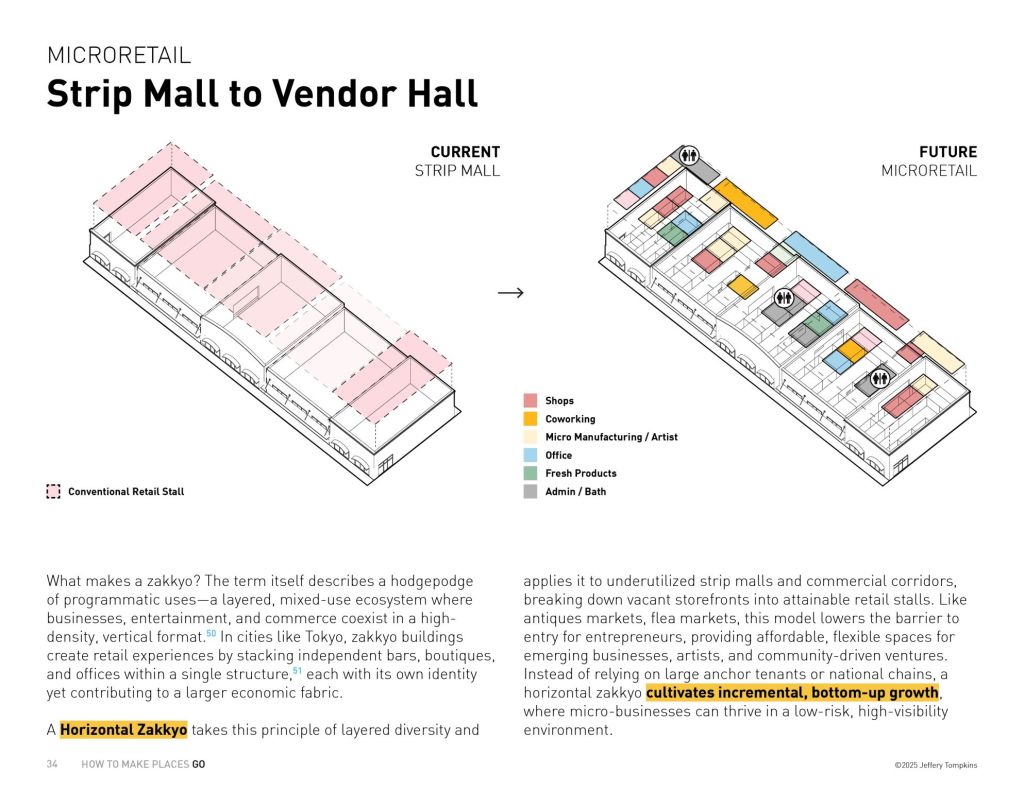
What has been proposed as the first pillar (as called by Minister Chris Bishop) is on matters very close to my heart, and I have long advocated for over the last 15 years as a Planner in Auckland. That is Mixed Use as of right, and intensification along our transit corridors! The other matter very close to me, the adopt of standardised zoning much like the Japanese zones is a work in progress as the reforms continue leading to that point!
Leading into Phase 3 of the Planning Reforms
Aotearoa-New Zealand has been on a bit of a journey trying to replace its existing planning law – the Resource Management Act 1991. The journey has culminated to the leading into the endgame, the Planning Act itself (which will replace the RMA). Before we get there though, the Ministry of Housing and Urban Development (HUD) is asking for thoughts into several key planning concepts that will determine how the Planning Act is shaped. Mixed Use, and intensification along key transit corridors are just two of the key aspects.
I have highlighted Mixed Use, and key transit corridors as not only is it an issue close to my heart (as well as mentioned in the discussion document) but I know cities around the world are grappling with similar situations. What goes on here in Aotearoa could either be lessons learned for international cities, or the lessons learned from international cities influence responses back to the discussion document here in NZ.
Below are those two aspects from the Discussion document (which you can see in full at the bottom of this post) being asked on from the Ministry. With the Mixed Use component more specifically there is a major play being made on Standardised Zones. What these standardised zones will not be known until the end of the year. However, if the Minister is looking to Japanese methodology with zoning, mixed use will be a major component as very few Japanese zones are exclusive single use (exclusive industry or inclusive residential were really the only two). NPS-UD = National Policy Statement – Urban Development. It currently guides planning in regards to our urban areas.
Key public transport corridors
- The NPS-UD requires Tier 1 councils to enable building heights of at least six storeys within at least a walkable catchment of existing and planned rapid transit stops.
- Under the NPS-UD, a rapid transit stop means a place where people can enter or exit a rapid transit service, whether existing or planned. A ‘rapid transit service’ means any existing or planned frequent, quick, reliable and high-capacity public transport service that operates on a permanent route (road or rail) that is largely separated from other traffic. In practice, this definition only captures the Wellington and Auckland metropolitan rail network and Auckland’s Northern and Eastern busways.
- There are several areas that are well-serviced by public transit and suitable for intensification that do not meet the current or proposed definition of rapid transit service. To address this, we propose to require major urban centres to also enable intensification across two new categories of current or planned ‘key public transport corridors’.
- a. Category 1 – Councils would need to apply a standardised zone that enables at least six storeys within a walking catchment of ‘category 1 key public transport corridors’, which we propose would be defined broadly in line with the New Zealand Transport Agency’s One Network Framework classification of ‘spine’ corridors. Spine corridors would be strategically significant corridors where many frequent services operate and many public transport services merge together to create very high frequencies and overall passenger movement.
- b. Category 2 – Councils would need to apply a standardised zone that enables at least three storeys within a walking catchment of ‘category 2 key public transport corridors’, which we propose would be defined broadly in line with the One Network Framework classification of ‘primary’ corridors. Primary corridors are strategic corridors where frequent public transport services operate, providing regular services across most of the day, seven days a week.
- Councils would be responsible for determining which corridors meet the definition of each of these categories.
Intensification catchments sizes
- To avoid unnecessary future debate about what constitutes a walkable catchment (and therefore where intensification is required), we’re proposing minimum intensification catchment sizes around city and metropolitan centre zones (or equivalent zones in the new resource management system), rapid transit stops and key transit corridors. These distances would be ‘as walked.’
- We’re considering two options for minimum catchment sizes.
- a. Option 1:
- i. 1,200 metres from the edge of city centre zones (or equivalent)
- ii. 800 metres from the edge of metropolitan centre zones (or equivalent) and rapid transit stops
- iii. 400 metres from the edge of the road reserve of key transit corridors
- b. Option 2:
- i. 1,500 metres from the edge of city centre zones (or equivalent)
- ii. 1,200 metres from the edge of metropolitan centre zones (or equivalent) and rapid transit stops
- iii. 600 metres from the edge of the road reserve of key transit corridors
- a. Option 1:
Enabling a mix of uses across urban environments – Current status and case for change
- There are many benefits from having a mix of land uses or activities located close to each other, such as:
- a. promoting competition, productivity and innovation
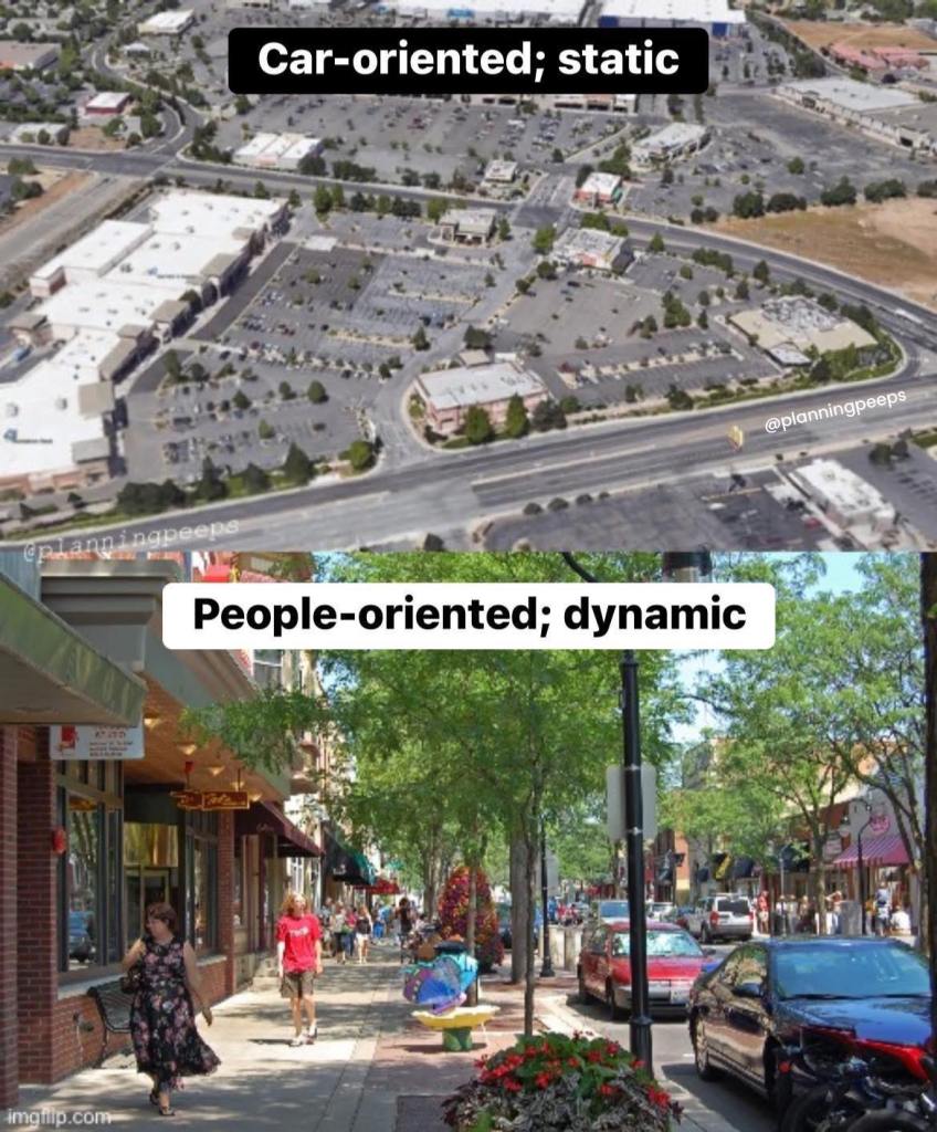
- b. more dynamic, liveable and attractive neighbourhoods
- c. making it easier for people to access amenities and opportunities nearby, including by walking and other forms of active travel.
- Council plans generally enable residential, commercial and community activities in commercial zones (albeit often subject to resource consent and a range of rules set out in district plans). Most residential zones are highly restrictive of what commercial and community activities can take place. Sometimes, mixed-use is addressed through ‘spot zoning’ – small patches of commercial zones in otherwise residential areas. However, zoning in and around the areas in which people live typically remains very restrictive of other activities.
- There is a key role for zoning and consenting to play in managing the interactions between different uses that could create nuisance factors for others, such as from housing being located next to activities that generate noise or emissions such as hospitality and factories. This means that councils play an important role in managing the impact that activities have on residential areas. Councils also impose restrictive zoning for other reasons, such as to maintain ‘centres hierarchies’, in which many certain types and scales of activities are only allowed to take place in certain commercial areas. For example, plans may allow only small shops and cafes in local suburban centres, with larger commercial activities required to locate in metropolitan or city centre zones. This can restrict areas from evolving naturally and responding to the needs of communities.
- We consider that there is scope for councils to enable a wider mix of activities in more places to achieve the benefits set out above.
Summary of proposals - The use of standardised zones in the new resource management system provides an opportunity to ensure zones provide for an appropriate breadth of activities to take place in proximity to each other.
- While the exact mix of standardised zones in the new system is still to be determined, overall we envisage enabling a greater mix of uses between residential, commercial and community activities in standardised zones than is typical at present. In line with the focus of the new system on managing externalities, we expect that where a zone does not provide for specific types of uses, or includes specific controls on activities, this will be based on avoiding or managing the externalities associated with that use.
- Some locations, such as near train stations or city and metro centres, may be particularly suited to providing for a wide range of uses. We’re considering whether councils should be directed to apply a zone that enables a wide range of uses in those areas.
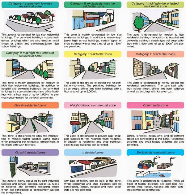
Paragraph 121 is the real clincher on how the Minister is leaning towards the standardised zones, and how Mixed Use will play an integral part. If paragraph 121 is carried out in its purist form and intention, then the standardised zones will be the same as Japan.
I have written on how Japanese Land Use Law could influence our planning especially the zones here: A Look at Japanese Land-use Law and its Influence on Proposed Aotearoa Planning Law
Of course any decisions on how this all ends up will still meet the very same complexities we face now: The Very Definition of Planning Complexity
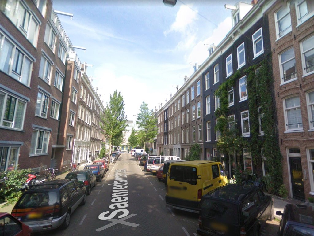
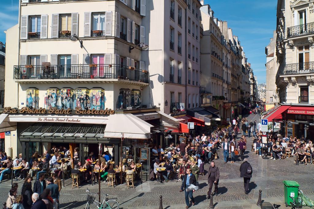
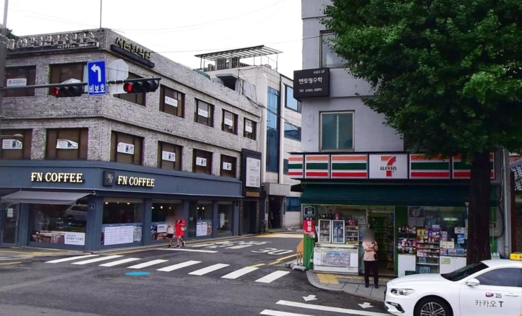
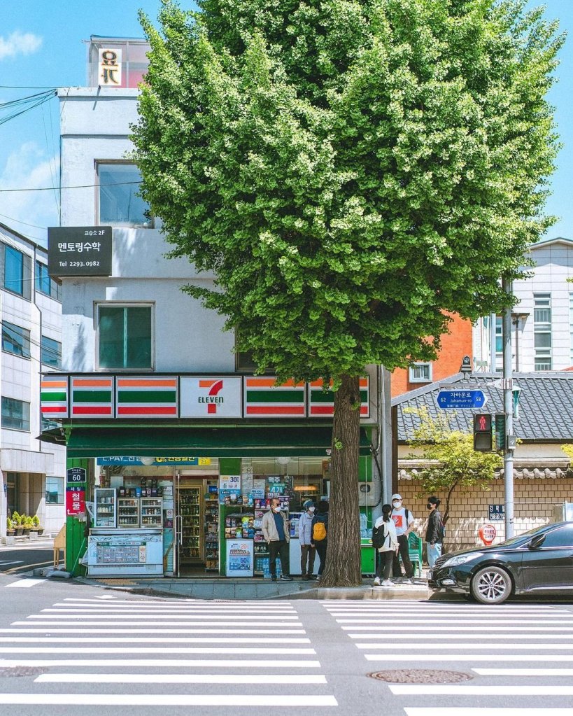
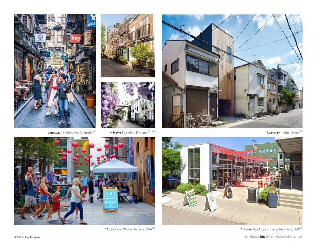
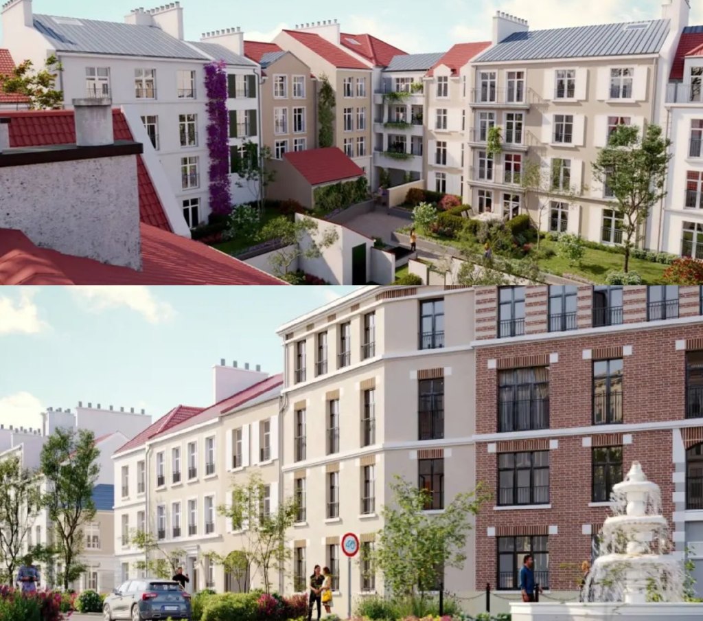
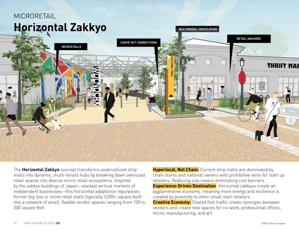
I will leave a slideshow on how Mixed Use can work at differing scales. To say the opportunities being endless would be galaxy-sized understatement!