Category: Planning

Looking at all things planning.
Check the Sub Categories for more specific forms of planning

The Clunker and an Unnecessary Road

The Weymouth Link – Is It Needed?


In short no!


I have commented on this with my “THE RURAL URBAN BOUNDARY – SOUTH END“” post last week – briefly recapping:

Personally I am in favour of the Draft Southern RUB Options – Corridor Focus (Page 4 of the embed) which contains primary urban development to Drury and Karaka (Core’s K and D), along the State Highway 22 and North Island Main Trunk Line rail corridor, the North East Pukekohe flank, and the Pukekohe South East flank. This option keeps the main development either near existing development or along a transit corridor making infrastructure provisions (Drury and Paerata Rail Stations) and access more easier than the other options such as those that include Karaka North and West. Per The Unitary Plan there is an option to retain a green belt between Pukekohe and Paerata which would provide a wildlife corridor as well as park space. While development is kept away from the highly valuable Pahurehure Inlet which according to the maps contains colonies of wading sea birds. In any case that area slated as Karaka North and West if need be can be converted either into lifestyle blocks with strict covenants or over time into a new regional park and green lung for the ever-growing Auckland (which is what I would prefer Council would do (like an Ambury Farm or Puhinui Reserve set up)).

I have also noted as potential transport link from Whangapouri to Weymouth via a new bridge over the inlet as well as talk of a new waste water treatment plant. With me preferring the corridor option thus Karaka West and North not being developed – but actually wanting to be flipped over to lifestyle blocks or even better a regional reserve I can not see the need for a transit link through that area connecting to Weymouth. That link would create a rat-run from State Highway 20 at the Cavendish Drive Interchange, down Roscommon and Weymouth Roads (Route 17), over the new bridge, down the new transit link and through to State Highway 22 just north of Paerata rather than containing it to State Highways 1 and 22. That kind of rat running would lower the amenity of the new Greenfield developments and do nothing to solve congestion issues. As for the waste water treatment plant, well with Karaka North and West no longer under development you can away plop the new plant there out of the urban road but near the potential outfall site.


Submission wise I am going to follow through and “recommend” to Auckland Council that the Corridor Option for the RUB being the preferred southern Greenfield development options, providing there is:

  • A green belt maintained between Pukekohe and Paerata

  • New waste water treatment plant is built

  • That transit link over the Inlet is not built

  • What was labelled Karaka North and West either be allowed to be converted to Lifestyle blocks or even better a regional reserve seeming wading birds live in those areas

  • And that Auckland Transport will build the Drury and Paerata Mass Transit Interchanges (rail and bus station, and park and ride)


But in this post I am going to open the floor to Manurewa Local Board Chair Angela Dalton with her Manurewa Action Team through her Scrid document:


Attribution to Angela Dalton – Chair of the Manurewa Local Board


And yes I am trundling along to the Weymouth Community Meeting tonight at 6:30pm discussing the Weymouth


10-26% Rail Utilisation?

Ummm – Bit Short Are We Not


After returning from the Papakura Unitary Plan feedback session this morning which was highly informative as I went one on two with Council Officers. I even learnt that Browns Bay on the North Shore who think they are in for 6-8 storey buildings are only in for four storey buildings looking at The Clunker in-depth. However, more on The Clunker later.


After my dialogue on The Unitary plan I had a discussion with Angela Dalton of Manurewa Local Board and two Papakura Local Board members (who I will look up their names shortly). The discussion came to the Glenora Road Rail Station at Addison, Takanini; 5-minutes from where I live. I was told that Auckland Transport are not doing Glenora Road Station AT ALL because of the $35 million cost for the station. $6 million for platforms, shelters, park and ride, kiss and ride and bus interchange (so a fully fledged station minus people manning it); $29 million for the grade-separation at Walters Road 50 metres south. AT forecasts the patronage figures at 952 daily using Glenora Road which I called Bollocks on straight away as a justification in not building the station.

I will also write a separate post on the Glenora Road situation and call AT on this as I know that station will attract at minimum five times that amount (952) as a conservative figure as the area grows (regardless of Takanini closing down or not).


But the 952 gives light to a mega-embarrassing situation that has not been aired yet on the Auckland laundry line. That is our honestly shameful rail utilisation figures which on average over 363 days a year (there are no passenger trains on Good Friday and Christmas Day) stands at 27,000 a day or 20.5% of potential patronage if we ran every train on average 67% full day in day out (see explanation at bottom of post). 

Let me run the numbers with you:


The Numbers using 325 services a day (average) per Auckland Transport


On existing services (there are 325 a day average according to the Fare Evasion Modelling) AT expects around 30,000 passengers a day. That means 92 passengers a service and our current diesel fleet holds anywhere between 350 to 750 depending on the train class (safe loading – not crush loadings). So 92 passengers means the train is anywhere between 12% full to 26% full AS AN AVERAGE as I know some trains are packed out.

Using 10 million as the rolling annual target we are at 27,000 passengers a day which gives an actual utilisation AVERAGE (weekends are in here) of 10-23% and we need around 40,000,000 rail passenger trips annually using the existing diesel fleet if the utilisation was at 67% (rather than 100% – see explanation below)


If we take the averages across the fleet (which with out diesels it does not make this easy as we have a heterogeneous fleet currently) then followed by the new EMU fleet all running at the maximum 6-car – top and tail config (two EMU-3s put together) this happens:

If the average diesel train holds 507 passengers average and 67% puts it at 339 passengers required, multiply that out by 325 services means you need Monday to Thursday 110,099 passengers a day to get ANY WHERE near turn over rates mentioned above. And yes I know the ADL-2 and ADK-4 can not hold 507 passengers – but this is averages here made out from the SA/SD 6 car sets holding 750 passengers. 


Let me try this for the EMU as EMU-6 car sets which hold 750 passengers

67% means 502 passengers and across the existing 325 services means you need: 163,150 passengers DAILY to make this viable, while AT is playing around with 30,000 a day or 92 passengers per train service. This means for an EMU-6-car running at an average of 12% full.

10-26% utilisation rate?

As a grand total figure we need with the EMU’s all running on just the existing provisions moving about 60 million rail passenger trips a year (this is at the 67% average utilisation rate) (so 6 time more than now) and we have not even stepped up the services yet to well over 400/day Monday to Friday at the minimum as planned.

 
This is mega embarrassing folks to have our existing rail utilisation at any where between 10-26% (92 passengers average for every single service – and depending on train type) per service which means Auckland is at no more than 18% of rail utilisation compared to its minimum viable capacity which stands at 67% of total maximum capacity – if we were carrying the 30,000 AT is modelling for at the moment. However remember as I mentioned above only 27,000 approximate people on average use the trains a day (10 million divided by 363 days)  which means knock another 2% off the utilisation rates.


I did say mega embarrassing now didn’t I? To be honest as an Aucklander I would be deeply embarrassed at the situation before us right now with our heavy rail. We have seen growth to above 10 million only for it to slip back below that milestone in February this year. But we seem to be stuck in a rut in getting the figures where it should be. AT forecasted the annual rail passenger trips near the 12,500,000 mark which means around 34,500 a day or a utilisation rate of around 23%, but that has slipped to 10.5 million so the figures fall back to around 30,000 a day.

We have a long way to go folks to get near 60 million annual rail passenger trips (might as well use EMU figures now with them coming on-stream soon) (60 million at 67% average utilisation across ALL 325 existing services) – which means the theoretical capacity stands at 90 million.


Still 9,996,066 annual rail passenger tips for the existing diesels and we need 40,000,000 for it to be viable, 60,000,000 when the EMU’s are all on stream. Remember this total average utilisation figure rises if you run more services. For example say the CRL is complete and all EMUs are running as 6-car sets holding a maximum capacity of 750 passengers and we go to 410 services average a day, 363 days a year. That means at 67% utilisation across  the services one would need 74,500,000 annual trips approximate for the entire operation to be viable. The Auckland Plan calls for by 2041, 140 million trips to be made a year by public transport – all modes…


Note: my figures are expressed as a percentage of 67% average utilisation or carrying numbers (which is 67% of the total maximum capacity) – not the actual total maximum capacity numbers (which would be 100% utilisation or carrying numbers). 67% was derived from the theoretical minimum all services would have to carry as an average for the Auckland Metro Rail system to be viable, and takes into account the system will be: 

  1. never at 100% utilisation across all services

  2. balances out across the services where are individual services are at 95-105% utilisation and others are around the 10% currently and also projected. It basically allows for a generous spread and average from varying patronage numbers per individual service.


So with this very embarrassing situation that makes me deeply embarrassed as an Aucklander to be confronted by this


The situation also reinforces my released Statement on Auckland’s Transport this morning which you can read below in the Scribd embed


I await Auckland Transport’s reply
 

The Unitary Plan is a Clunker

1854 Pages?


I have mentioned in the past that the Draft Unitary Plan was around 500 pages and it was larger than our largest Bible at home. Well it seems I got that number wrong as the Draft Unitary Plan actually stands at 1854 pages and takes Councillor George Wood two car trips to get the sole Council copy of this clunker to a public meeting.


1854 pages? What the flying heck Auckland Council, that is not a plan but just an actual dead weight to anyone and everything in the city. Maps aside, the idea was to get this clunker down to 100 A4 pages so that it was easy for everyone to read to access. Not just be a play thing for city planners and Environment Court Lawyers that costs us more money.


Bernard Orsman for the NZ Herald had this to say on the Clunker this morning:

Struggle to access copies of city plan

By Bernard Orsman @BernardOrsman

5:30 AM Thursday Mar 28, 2013


Navigating complex document online and finding a printed version proving difficult.

Many Aucklanders are struggling to find out if their neighbourhood is earmarked for high-rise apartments, heritage protection or the status quo in the new planning rulebook for the city.

The 1854-page draft unitary plan includes provisions for high-rise and multi-rise apartments and the nuts and bolts of what people can do with their properties.

But people are complaining about difficulty using the online version of the plan and trying to access 29 hard copies at local board offices, Auckland Town Hall and some libraries – about one copy for every 50,000 people.

At a public meeting in Mt Eden on Tuesday night, there was no material for locals to take away on the changes proposed for the suburb, only a single copy of maps to browse.

Birkenhead resident M. Carol Scott said in a letter to the Herald that she found the online document a “tortuously clunky process” and all she got from her local library was a brochure inviting her to “shape the world’s most liveable city”.

“Clearly, creating a Super City planning rulebook is a huge task, but how democratic is this process?” she said.

The Auckland Transport Blog said unlike the Auckland Plan – the 30-year blueprint for the city – the new rulebook was not a nicely worded document, but a complex, hard-to-use resource management document.


You can read the rest over at the Herald


Personally I am not finding the e-document that easy to use and I regard myself as tech savvy. Even with Bookmarks applied in Chrome and until I saved the PDFs to my hard drive, it would take several attempts floundering around different parts of the Unitary Plan site to get to the two areas I am focusing on at the moment: The Rural Urban Boundary addendum, and the Zoning Rules in an effort to get them simplified even further.  What is not helping is that you can read the PDF like the RUB material in question, but then you have five different maps showing “options” for the RUB rather than consolidating it as one PDF file. Thankfully I consolidated those maps into a single PDF and stuck it in Scribd last night – but heck that is annoying to do what the council should have done in the first place.


As a result in the Unitary Plan being a clunker and at over 1854 pages making it impossible to print – even if I did get the entire thing as a single PDF, getting a meaningful submission in is going to be an interesting task ahead.


However, I am off to the Papakura Local Board Unitary Plan session next month to see if I can make heads or tails of The Clunker before getting my submission in.


And now that I have that little rant off my chest this morning, my next Unitary Plan post will be on residential zoning. It’s Sim City meets Auckland Unitary Plan – here at BR:AKL


BEN ROSS : AUCKLAND

Shining The Light – To a Better Papakura (OUR home)
AND
To a Better Auckland – (OUR City)

Auckland 2013: YOUR CITY – YOUR CALL


Integrated Transport Program Approved

$60 Billion – 30 year ITP Approved


I was at the Auckland Transport Board meeting today listening in on the Integrated Transport Program as well as (and mainly) any blood-letting from the latest patronage figures I alluded to earlier this week.


The AT Board did today however, did approve the $60 billion – 30 year Integrated Transport Program. In short the ITP brings together finally a single approach in dealing with all of Auckland‘s transport system from road to rail, car to train, cyclist to walker to ferry. The ITP also lists the amount of money needed – an eye watering $60 billion to maintain and renew existing transport assets while also investing in new transport assets as well. But as the ITP report states as embedded below; the funding is $15 billion short of the $60 billion needed. To make matters more interesting despite the investment via the ITP, Auckland will still be apparently worse off – go figure?


I’ll investigate this some more over Easter but for now happy reading


The Integrated Transport Program


The Rural Urban Boundary – South End

The Unitary Plan


And


The Southern Rural Urban Boundary


I have been meaning to get this up this morning but the perennial issue called Auckland Transport has being cropping up again.


So the Unitary Plan is out for informal feedback from Auckland and we have central government sticking its nose in our affairs when it should learn to butt out. Commentary on the Unitary thus far has been rather weak on the actual issues at hand: the rules, the zones, the RUB, the infrastructure deficit which is eye watering, and how to deliver all this from (at this rate) September. Then again once our Deputy Mayor gets MP Nick Smith out of the city and tell him to butt out as he is being counter-productive attention might be drawn back to the rule book that affects the lives and businesses of Aucklanders.


As mentioned before I went away on holiday, commentary on the Unitary Plan will start as BR:AKL looks at the issues at hand. At the same time a series on an alternative to the Unitary Plan will run in parallel to Unitary Plan commentary. Today I am going to look at the Southern Rural Urban boundary where upwards of some 57,400 new Greenfield dwellings could end up depending on the option. This kind of Greenfield development stems from the Auckland Plan calling for 60% of urban development to happen in Brownfield land with the other 40% in new Greenfield land. The Southern Rural Urban Boundary (RUB) is one such spot (the others being in the North and North West of Auckland) where some of that 40% is meant to go.


For those wondering what a Rural Urban Boundary is, please check THIS LINK from the Unitary Plan on its description.


As for the Southern RUB there are three development options Auckland can take with this Greenfield Land (which is 15 minutes away from where I live by car). You can see all three options layered over a GIS Map and a GIS Map with an Issues and Constraints Overlay as well as each of the three options below in the embed below:

The two GIS maps (pages one and two) have dwelling capacity limits for each of the Greenfield zones depending on which option is taken.


Personally I am in favour of the Draft Southern RUB Options – Corridor Focus (Page 4 of the embed) which contains primary urban development to Drury and Karaka (Core’s K and D), along the State Highway 22 and North Island Main Trunk Line rail corridor, the North East Pukekohe flank, and the Pukekohe South East flank. This option keeps the main development either near existing development or along a transit corridor making infrastructure provisions (Drury and Paerata Rail Stations) and access more easier than the other options such as those that include Karaka North and West. Per The Unitary Plan there is an option to retain a green belt between Pukekohe and Paerata which would provide a wildlife corridor as well as park space. While development is kept away from the highly valuable Pahurehure Inlet which according to the maps contains colonies of wading sea birds. In any case that area slated as Karaka North and West if need be can be converted either into lifestyle blocks with strict covenants or over time into a new regional park and green lung for the ever-growing Auckland (which is what I would prefer Council would do (like an Ambury Farm or Puhinui Reserve set up)).

I have also noted as potential transport link from Whangapouri to Weymouth via a new bridge over the inlet as well as talk of a new waste water treatment plant. With me preferring the corridor option thus Karaka West and North not being developed – but actually wanting to be flipped over to lifestyle blocks or even better a regional reserve I can not see the need for a transit link through that area connecting to Weymouth. That link would create a rat-run from State Highway 20 at the Cavendish Drive Interchange, down Roscommon and Weymouth Roads (Route 17), over the new bridge, down the new transit link and through to State Highway 22 just north of Paerata rather than containing it to State Highways 1 and 22. That kind of rat running would lower the amenity of the new Greenfield developments and do nothing to solve congestion issues. As for the waste water treatment plant, well with Karaka North and West no longer under development you can away plop the new plant there out of the urban road but near the potential outfall site.


Submission wise I am going to follow through and “recommend” to Auckland Council that the Corridor Option for the RUB being the preferred southern Greenfield development options, providing there is:

  • A green belt maintained between Pukekohe and Paerata
  • New waste water treatment plant is built
  • That transit link over the Inlet is not built
  • What was labelled Karaka North and West either be allowed to be converted to Lifestyle blocks or even better a regional reserve seeming wading birds live in those areas
  • And that Auckland Transport will build the Drury and Paerata Mass Transit Interchanges (rail and bus station, and park and ride)


I will keep tabs on this and see which way Council swings on this once the Unitary Plan becomes near operational – whenever that may be

Welcome To Auckland

Where We Take Our Time


Someone is going to like me for this

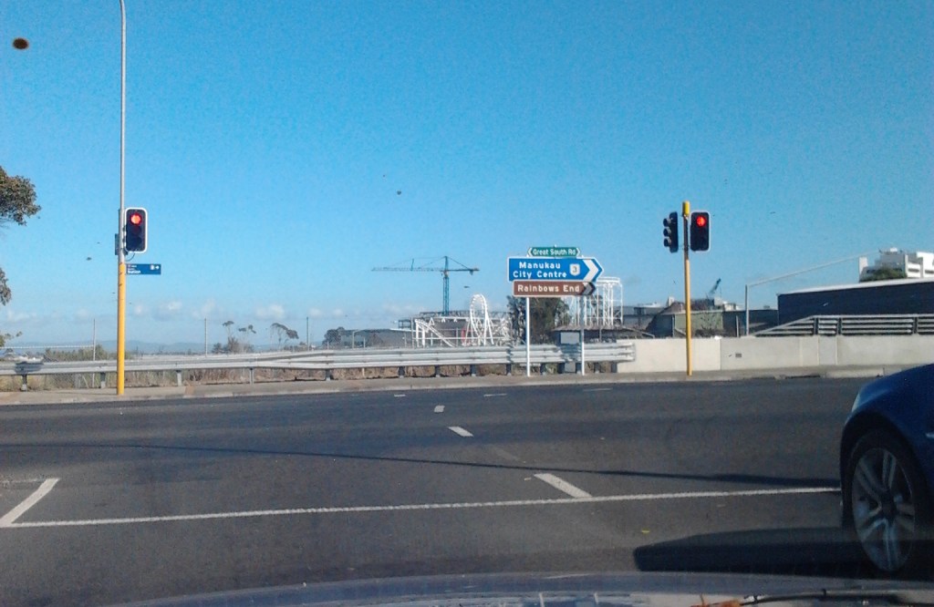
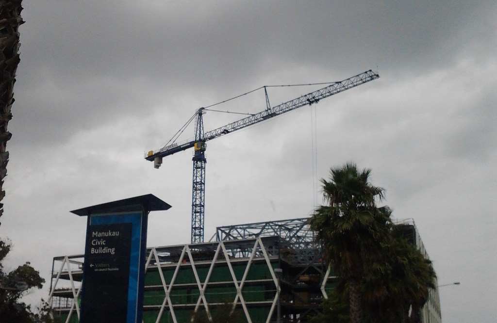
I am in Australia for two weeks and go into Manukau to conduct my business today and look what I see:

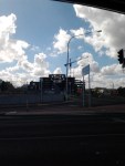
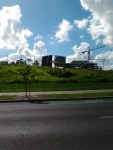
No movement what so ever in the construction of the MIT Building and AT Bus Interchange next to the Manukau Rail Station. It still looks like a shell and still looks dead with no activity.


There is a sign (that didn’t show up in the photo well) that does say MIT (and the bus interchange) will be open Mid-2013. I like to see this opening date still met with the site in its current form.

And as of last month, Auckland Transport were not aware of any delays of installing the gate line and ticket office down at Manukau. I might go check that out tomorrow and give an update to the Transport Committee.


So much for thinking work did resume on the project down at Manukau…