
Why are we waiting Auckland Transport and Panuku?
UPDATE FROM AUCKLAND TRANSPORT:
Improvements to Ronwood Avenue are proposed through both the Connected Communities and Airport to Botany Rapid Transit programmes.
The section of Ronwood Avenue between Great South Road and Davies Avenue is part of the Connected Communities Great South Road corridor. The business case for this corridor will apply a multi-modal lens to Ronwood Avenue with a particular focus on safety improvements and the provision for cyclists and public transport. Public engagement was scheduled for April 2020, but has been postponed due to the Covid-19 lockdown. We are currently assessing the impact of Auckland Council’s emergency budget on the Connected Communities programme.
In the longer-term this section of Ronwood Avenue provides a key link in the Airport to Botany Rapid Transit corridor. The current concept-level design for the corridor includes a centre-running bi-directional busway between Davies Ave and Great South Road, with traffic lanes and walking and cycling facilities on both sides of the road and additional signalised crossings. A rapid transit station is proposed to be located on Ronwood Avenue.
Ronwood Avenue also sits within the study area for the Manukau Cycling Business Case which will identify a network of cycling improvements for Manukau with a particular focus on the metro centre. This business case will commence in the coming months with initial public engagement indicatively planned for late 2020.
Thank you and kind regards,
Basically waiting on money. So where did that $90m from the Panuku Our Manukau Land Sales go?
At the moment I am doing a refresher course in all things Tactical Urbanism. I am currently writing a short paper on examples of Tactical Urbanism (needed to pass the course) and need to cite examples. Citing overseas examples was easy enough, citing Auckland examples was a not a pleasant experience.
Through the course I was flooded with all these overseas examples of small and large scale Tactical Urbamism projects, when asked about Auckland I had to sheepishly reply that we started with 17km of tactical urbanism but went back to near zero after our first Lockdown. Queen Street continued but that was after Auckland Council took the project off Auckland Transport
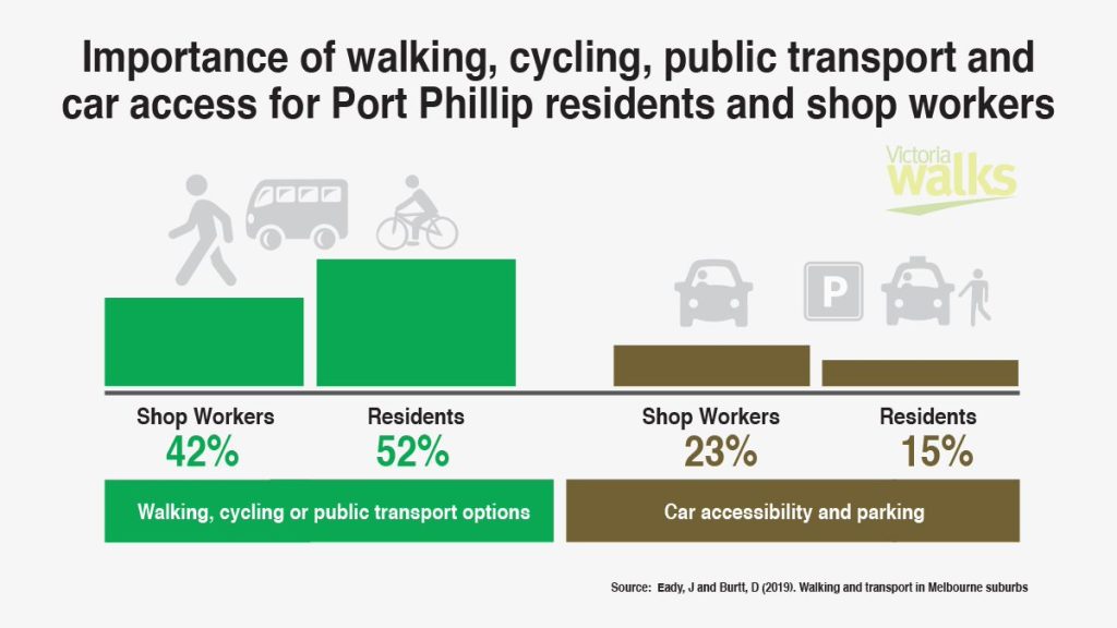
And despite all the literature out and even found through my course that included stating that removing cars out of a Main Street leads to a 40% increase in revenue for retailers and hospitality agents, Auckland Transport still drags the chain while progressing with 4-lane roads.
To show the inherent classism in our Institutes we look no further in who gets the Tactical Urbanism funding pie. Auckland City Centre gets Tactical Urbanism but what about Manukau City Centre? Both contribute 7.4% to National GDP or 14.8% combined. Auckland produces 38% of all GDP so we are not dealing with Chump Change from our two Centres.
Southern Auckland also houses our industrial complexes (except for one at Southdown) and is the largest and fastest growing Sub-Region in terms of population, population and economic growth in Auckland. Covid will not doubt have altered the dynamics as well. Auckland City Centre is currently deprived of international students and tourism while single use office towers face greater vacancy levels as businesses adapt to Working from Home thus head out to the Metropolitan Centres. Meanwhile Manukau and her four big Heavy Industrial Complexes continue to operate at near full power (the mall and Rainbows End are closed but will reopen soon).
So the question is if Auckland City Centre gets tactical urbanism (while that City Centre is steering down the barrel of decline) why is Manukau City Centre missing out (as it continues to expand)?
A Main Street for Manukau City Centre
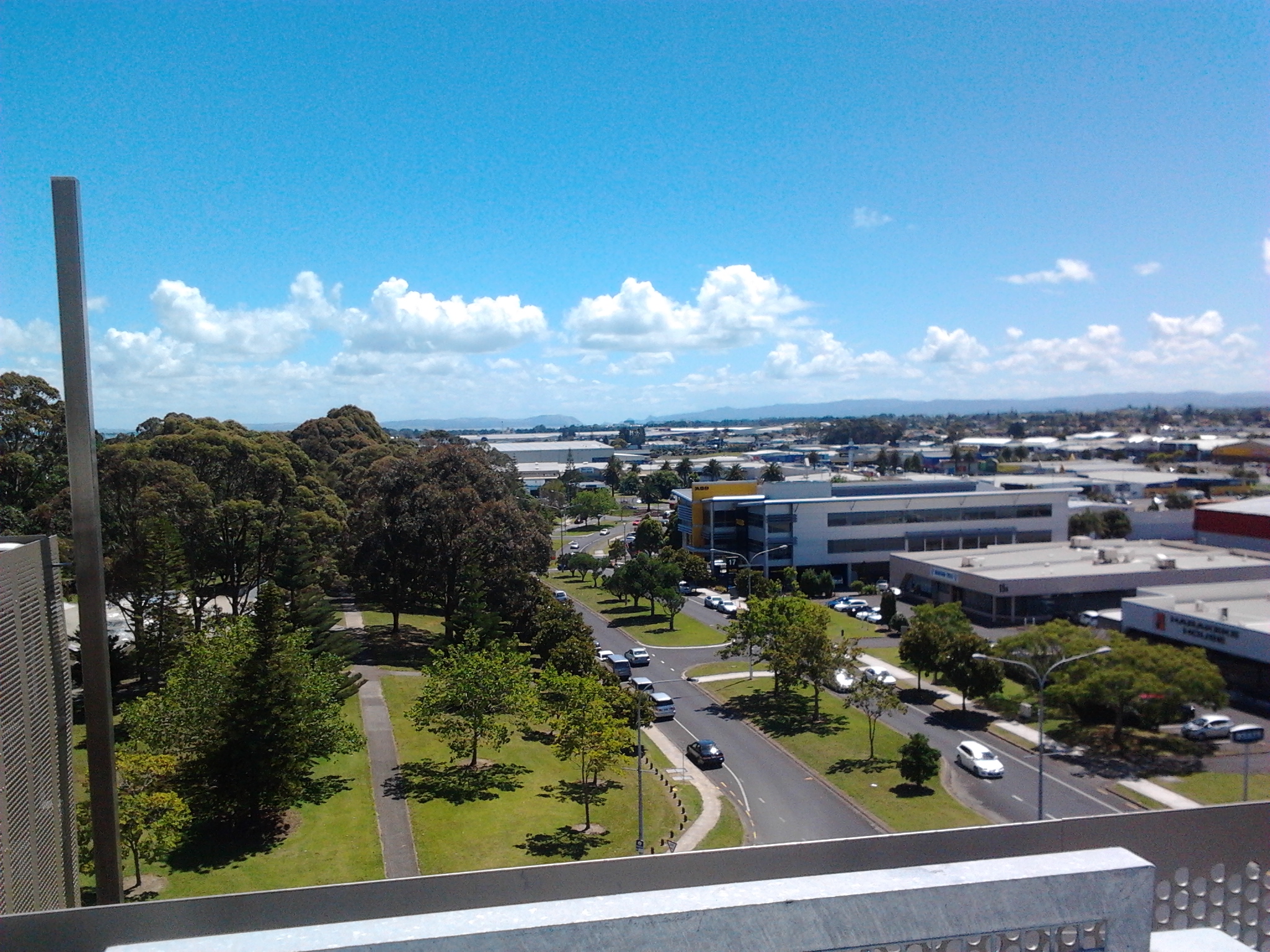
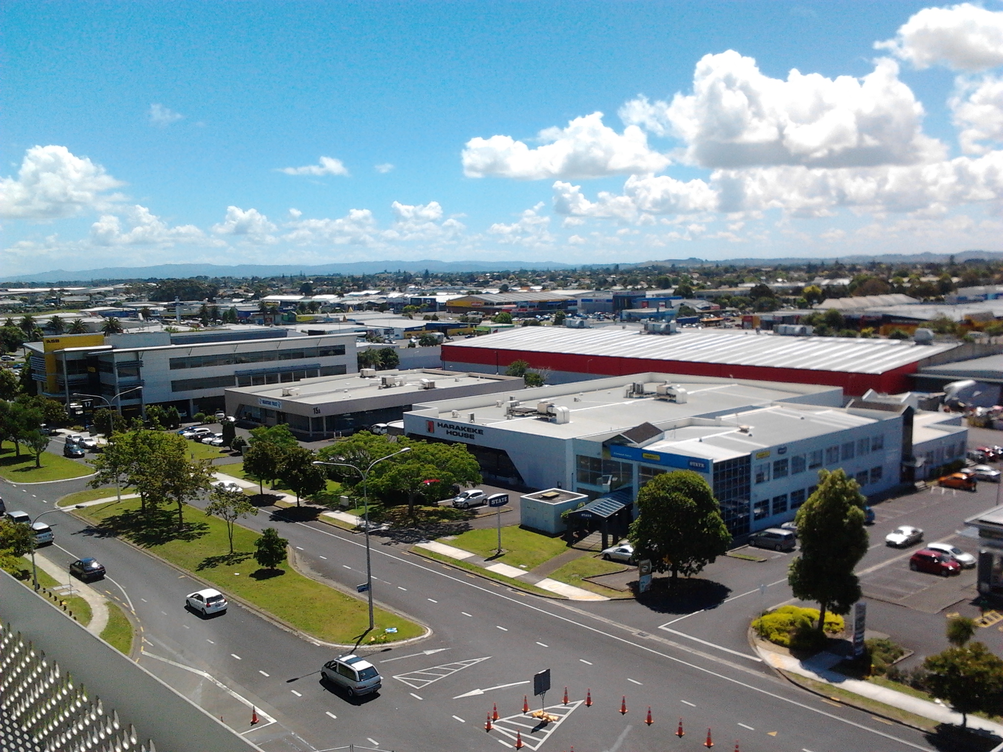
Manukau City Centre despite being built and designed in the 1960’s is actually blessed in its street layout.

Manukau has a grid pattern with the larger arterial roads forming a twin border around the main Core while smaller streets and large boulevards run through the middle. This makes tactical urbanism in Manukau very straight forward.
So where did I have in mind? Ronwood Avenue, the main east-west street that runs right through the guts of the Manukau City Centre Core.

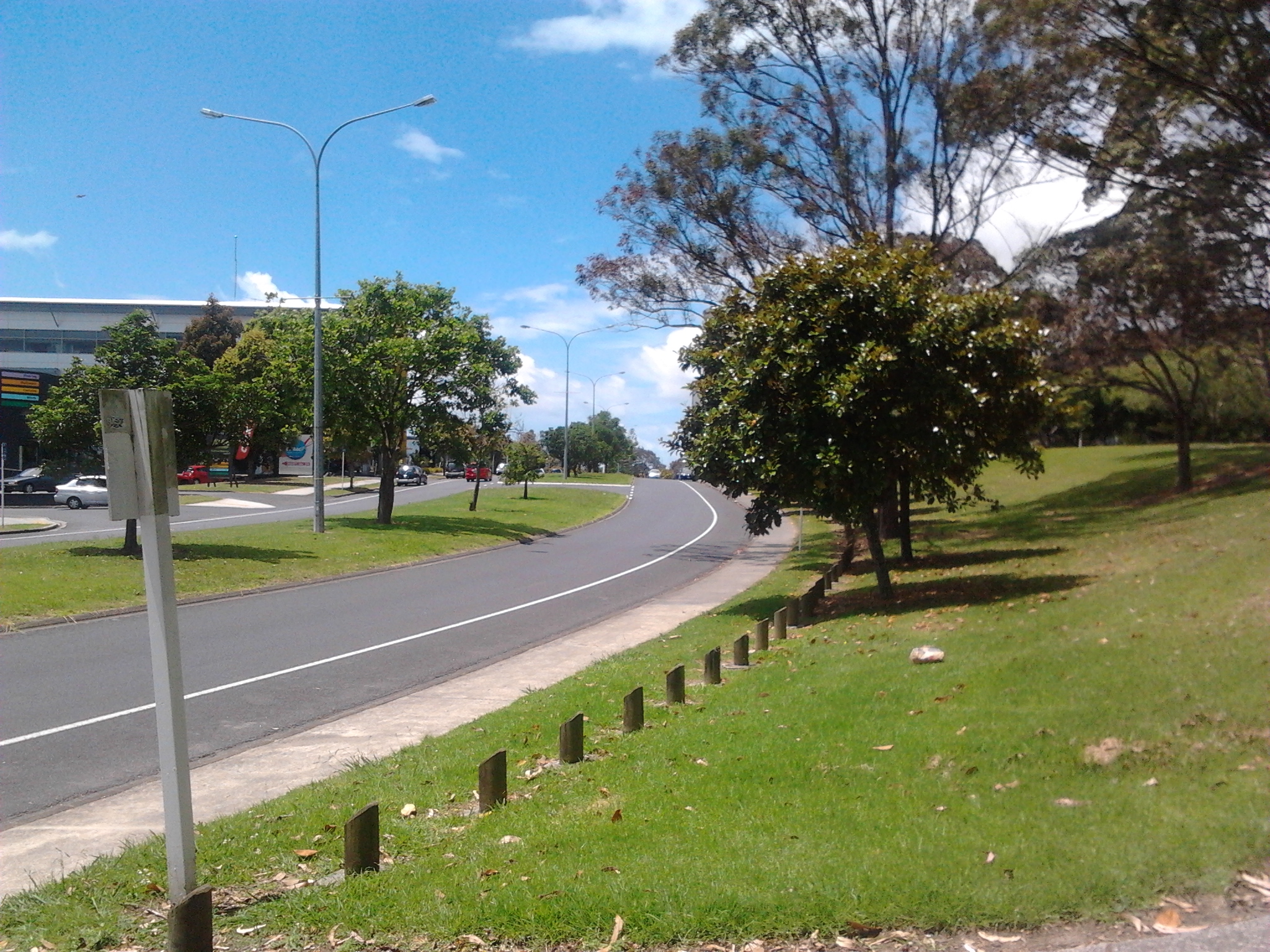

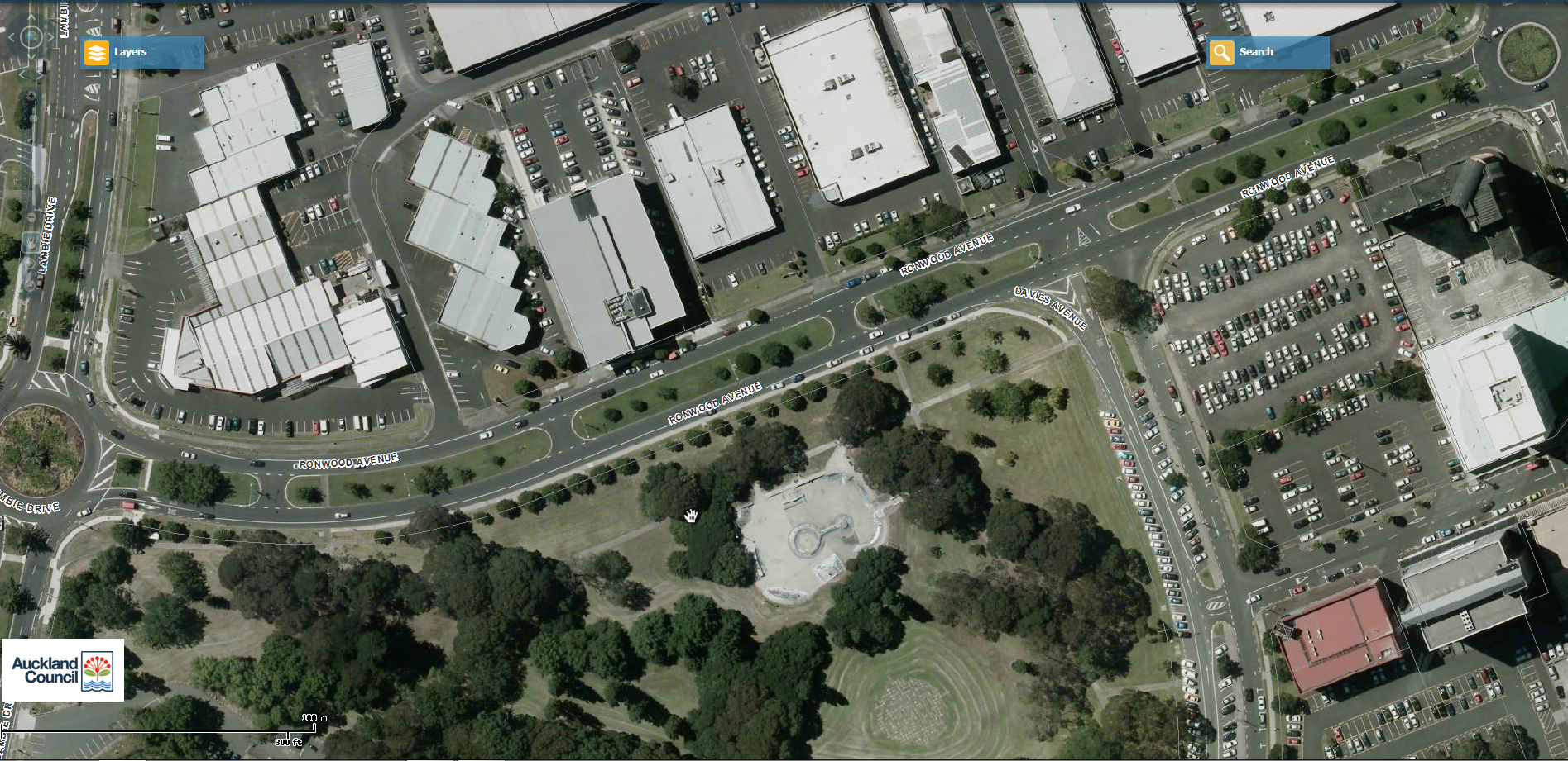
Ronwood Avenue is a 24-32 metre wide two lane road with a large grass median in the middle of it. Each side has on-street parking on it as well (some paid, some free). Ronwood Avenue will also take part of the Airport to Botany (A2B) – Airport Link route as it snakes its way through Manukau on its trip to either the Airport or Botany.

I don’t quite think we need 32 metres of road corridor for two lanes of traffic and on street parking when there is plenty of parking through out Manukau.
So what to do?
Tactical or Strategic Urbanism for Ronwood Avenue
The road widths on each individual section of Ronwood Avenue are wide enough for two lanes of traffic (one each way) with the speed limit set to 30km/h. What do we do with rest of the corridor? Given social distancing will be a semi permanent feature of New Zealand for the rest of the decade, and the compelling evidence from overseas on how to increase revenue takings for business it is time to humanise Manukau’s Main Street!
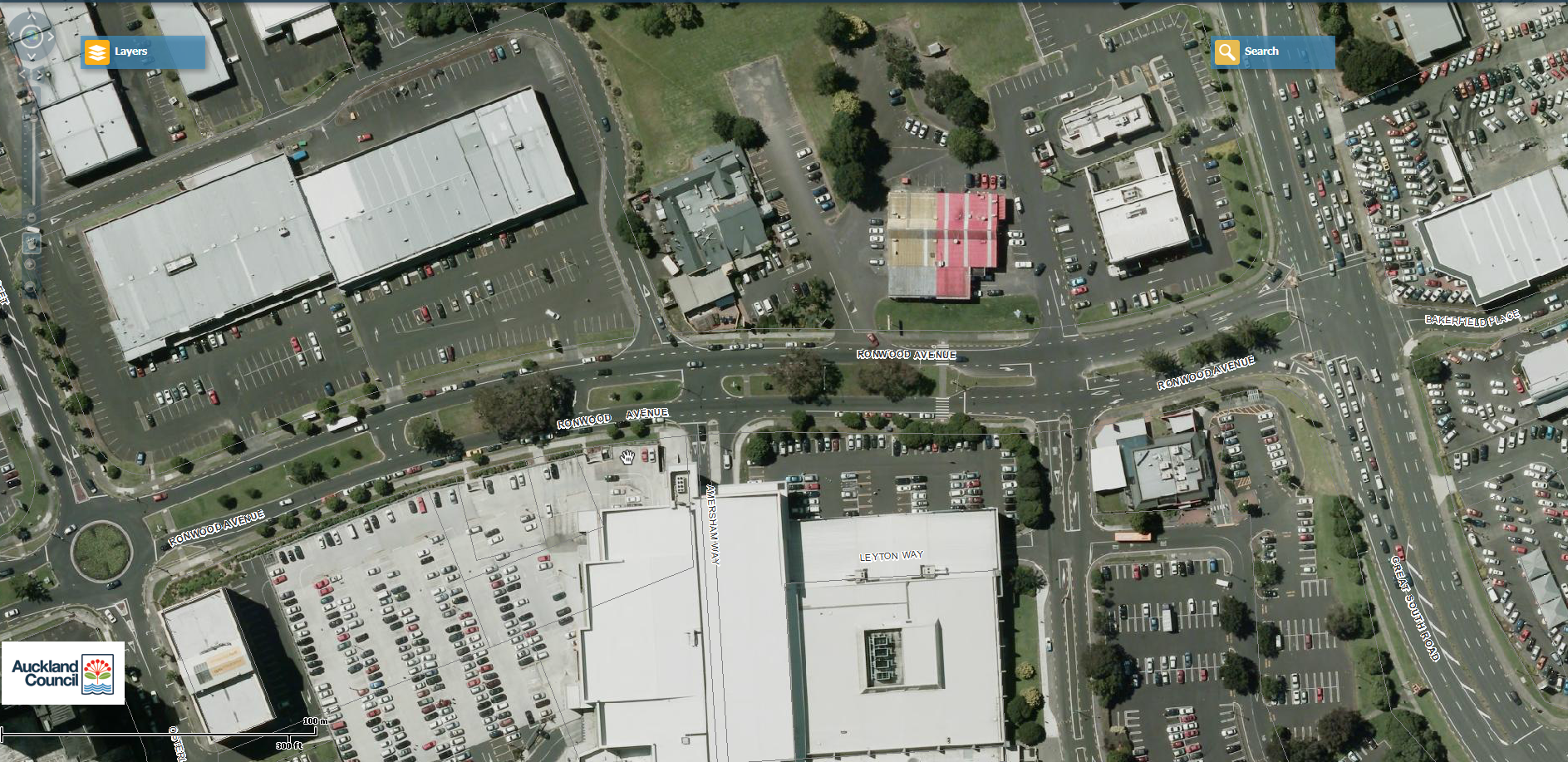
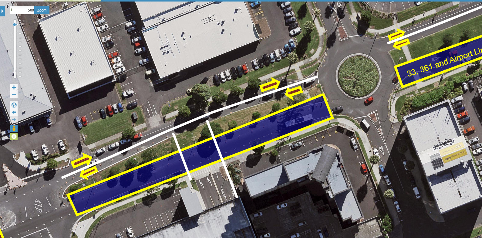
Owing to the Airport Line (A2B) I have had to divide Ronwood Avenue into two sections. Red for the boluevard and blue for the A2B Transit Way.
The Ronwood Boulevard


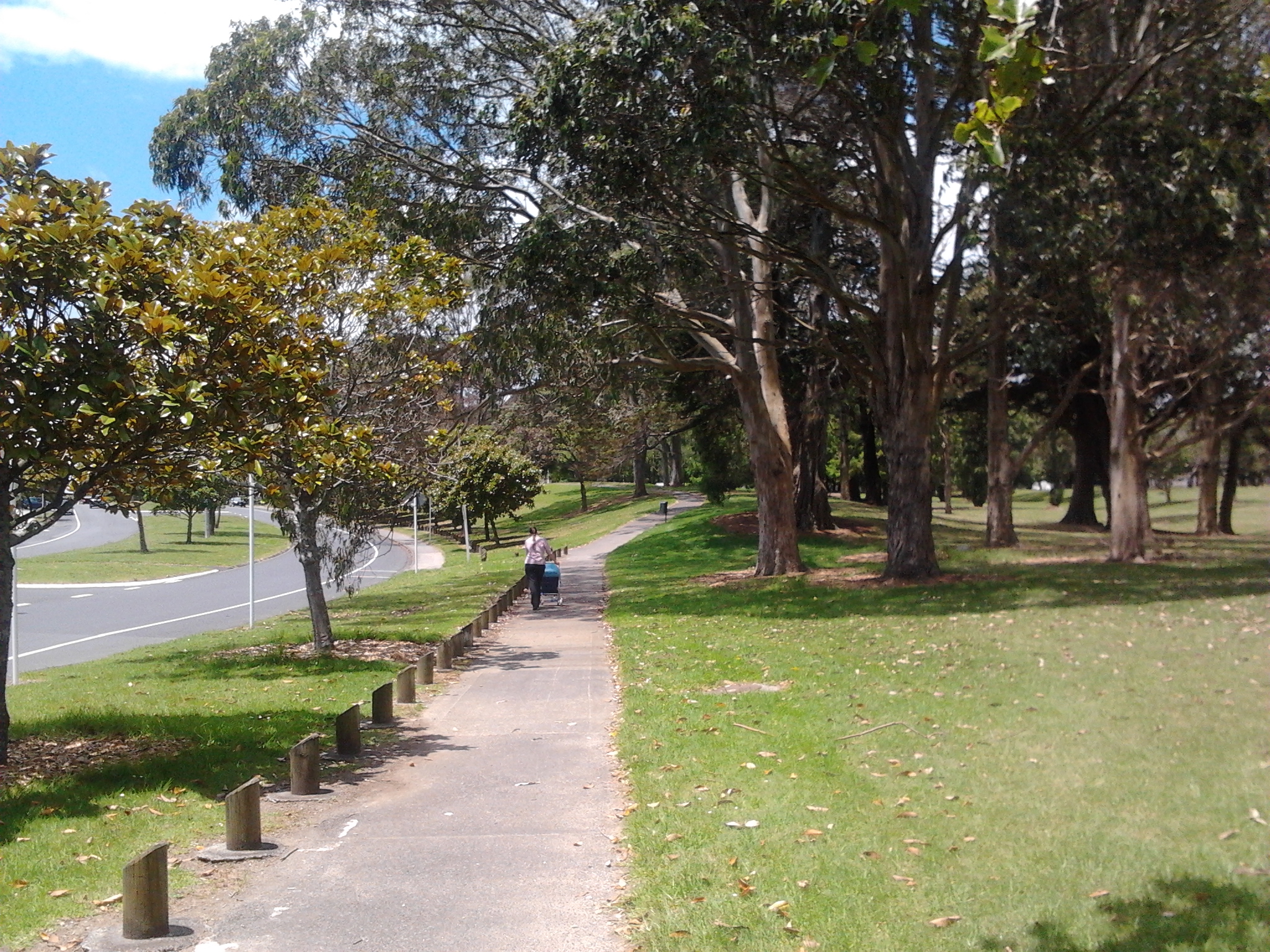
You can see the road width on one side is wide enough for 2-lanes of traffic. The other side would become an active mode (walking/cycling) in front of Hayman Park.
Interestingly enough the space would be wide enough for food trucks, and other mobile businesses to create a mini market while we can maintain our social distancing. As the Boulevard links two main retail areas and is also next to Hayman Park foot traffic would not be a problem. Result? JOBS!
The Manukau Transit Way
The sections in blue would be the Manukau Transit Way. The Transit Way would connect between Davis Avenue and the Great South Road and would include a mini hub between Melba and the main mall car park entrance. We have to remember the Airport Link and the 33 Great South Road would be using this transit way every 10-15 minutes while the 361 about every 20-30 minutes. So three bus routes would be on the transit way and need to be separated from general and goods traffic in the area.
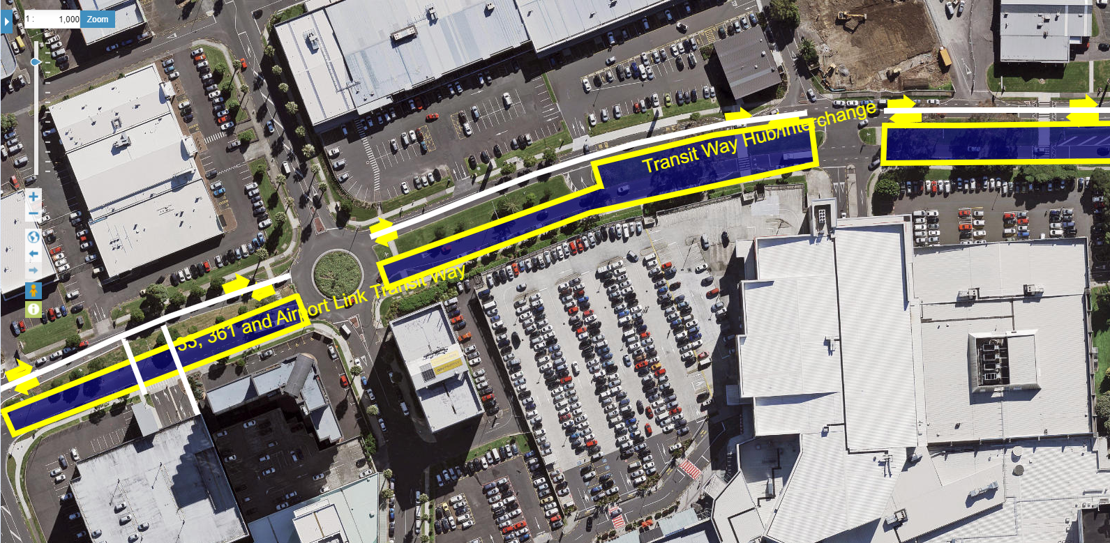


I chose the south side of Ronwood Avenue so as not to conflict with driveways to business on the northern side. The only one of concern is to an apartment tower but very easily fixed.
As I noted earlier a transit hub or interchange would be built around a nexus of business typologies and suited for renewal or intensification. Separating the buses (and maybe later light rail) out from general and goods traffic allows efficient movement of buses through this busy section of Manukau, especially as the area intensifies. The transit way would also kick off intensification as well.
Both sub-schemes for Ronwood Avenue are not expensive and can be even done with temporary measures such as paint, concrete planter boxes and signs before we go with fancy paving etc, etc and etc. Wayfinding would also be a must but the main benefit of this proposal is jobs. Jobs in building the Boulevard and Transit Way, jobs in supporting a mini market, jobs from intensification supported by the Transit Way.
So if Auckland City Centre can get Tactical Urbanism then why does a little City Centre like Manukau have to wait for theirs?
A little City Centre waits – it should not!


