Do Large Language Models have a place in Planning, and can they be used in Planning?
This is a cross-over post and will appear and and my Cities Skylines Blog, Ben’s Cities
A recent post on LinkedIn by a Transport Planning counterpart was outline the potential use LLMs (Large Language Models or its misplaced name AI) in Transport Modelling and Planning had me thinking about the applications of LLMs in Spatial and Policy (otherwise known as Land Use) Planning (as these is my main areas). I then realised I already use LLMs in the Planning sphere for at the moment strategy and theoretically consenting.
I’ll give the TL:DR here with links in the comments:
- My submission to the Planning Bill is the Planning Law, in particular Parts 1-3
- LLM is used to create the supplementary documents that form Schedule 2 in the Planning Bill, and the Spatial Plan manual (basically a how to implement Parts 1-3)
- Using the urban simulator Cities Skylines 2 (basically agent modelling), a two new cities were created. CS2 has a set of standardised zones, as Standardised Zones will be used in New Zealand’s new planning regime
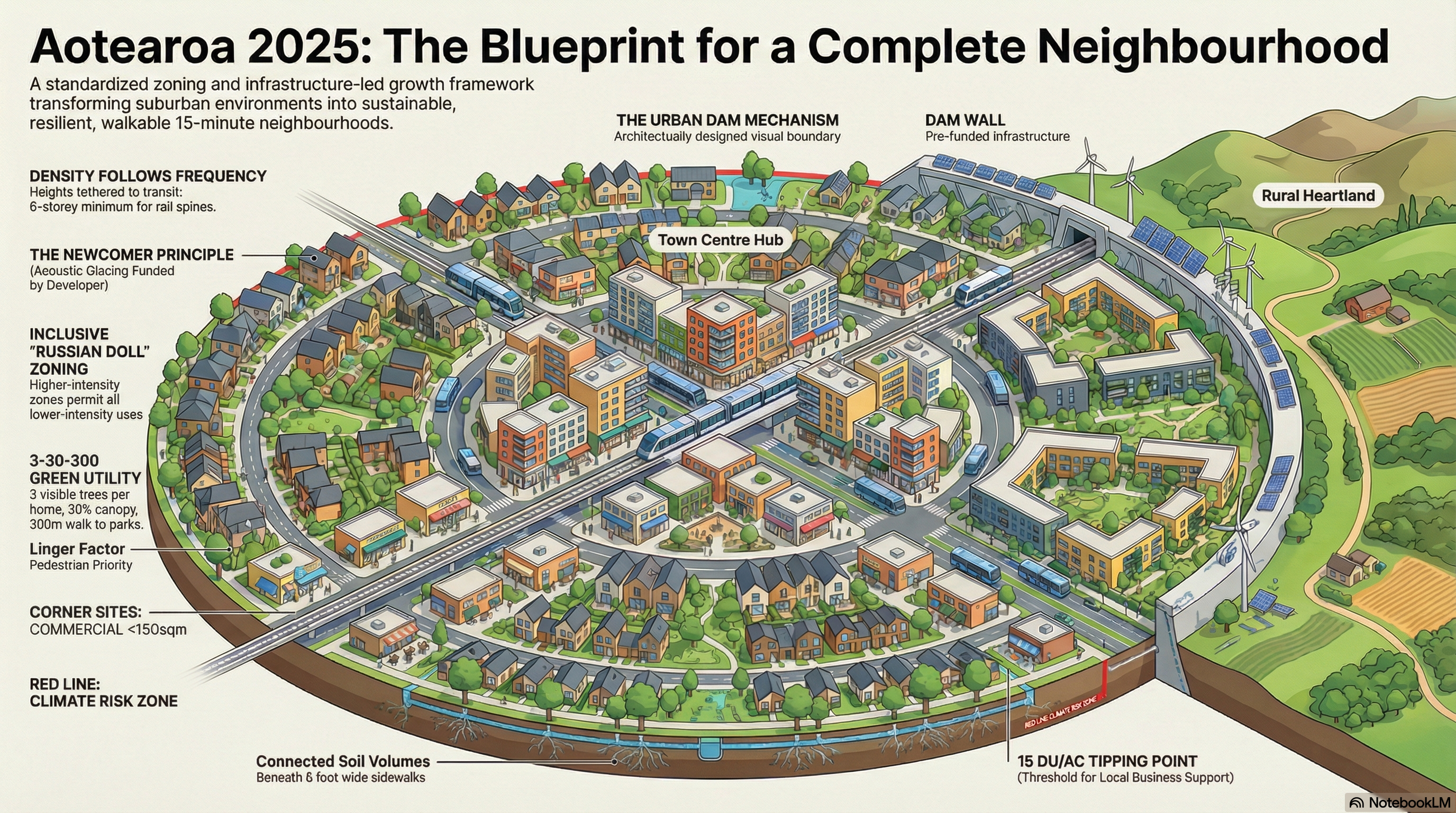
- The LLM is used to “create” a Site Placement, and Master Blueprint using material from 1-3 above. International best practice material is also added to supplement as Planning is not a vacuum (and never should be).
- With the core requirements created and the Site Placement, and Master Blueprints produced by the LLM, the agent model or rather urban simulator CS2 is now loaded with data layers open.
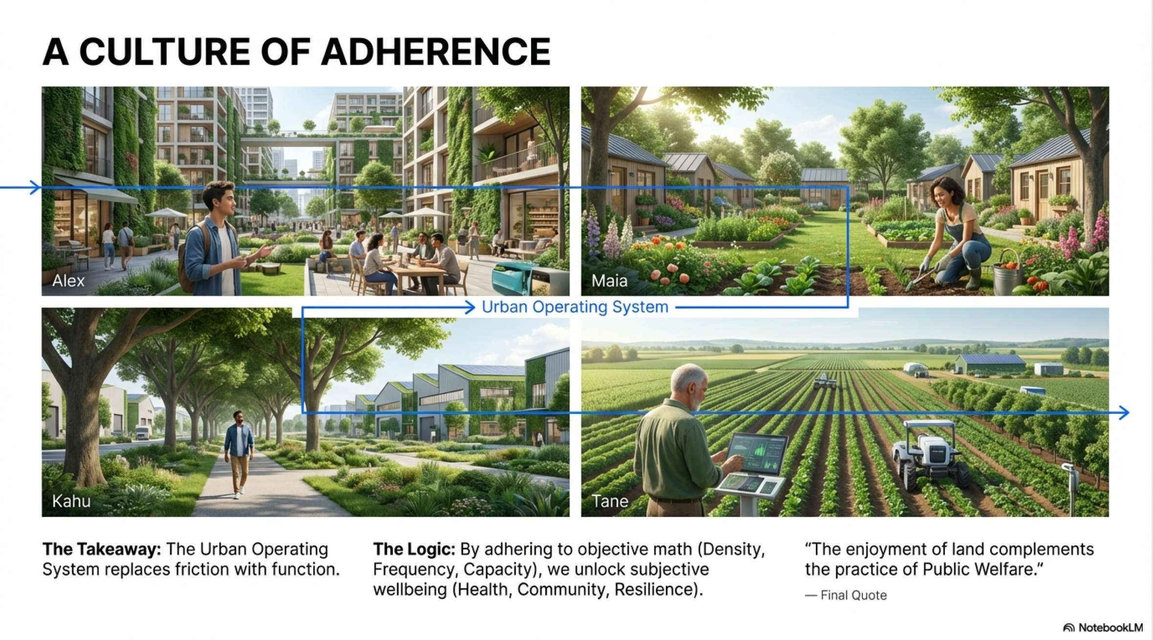
- With the CS2 data layers open, Spatial Plan (which is still done by pencil and butter paper overlaid on maps) is drawn up. The Spatial Plan outlines how the spatial form will take place and more to the point in the spirit of Spatial Planning how the spatial form will influence human behaviour and vice versa. The supplementary material in (2) is also on hand as technical guidance for the Planner.
- The City is built and running based off the Spatial Plan. Further site specific plans much like Area Plans are drawn up and/or referenced for each urban/rural geography context (I have four already drawn via the LLM up as a universal reference)
The Site Placement, and Master Blueprint. Versions 1 and 2
And that is where I am currently in developing, experimenting, and analysing the use of LLMs in Planning as part of the Strategy side.
To continue with the experiment; I need to cities to level up before casting the LLMs back over it to see if I am meeting KPIs set out in the various documents but mainly the Schedule 2 Strategy sets. This is before setting about further modelling out gremlins seen when I am at First Person Level using the transport system in the city. Also I need to test a consenting scenario where a large integrated development is to be done through using the LLM to create the Master Plan which becomes the consent document itself. A reminder that LLMs are also used to create the story for the ratepayers on progress of the city 😅.
None-the-less it will be an interesting experiment crossing the LLM’s with an urban simulator especially as NZ planning moves to the standardised system (which the LLMs and urban simulators do excel at.
Links to respective material below.
The Planning Bill Submission and the supplementary material that spun off it:
The Spatial Plan requirements as would be required under Part 3 and Schedule 2 of the Planning Bill, modified to my submission:
The Cities Skylines 2 city that will be testing my Planning Bill submission
Using the LLM to start drawing up site specific blueprints or Area Plans