
Manukau’s 21st Century Development
Part of the “Looking at Developing a 21st Century Auckland” Series
At the moment I have zoned in on Manukau as the centre point of the “Looking at Developing a 21st Century Auckland” series. While Manukau is my “home” hub owing to the fact I reside in Southern Auckland, the wider development strategy is part of both Developing a 21st Century Auckland AND the fact that battles will be won or lost in the suburbs.
For recaps please see the following posts:
- Looking at Developing a 21st Century Auckland – Series – Surburbia
- Looking at Developing a 21st Century Auckland – Series – Drawing Up Next Post
- Manukau Interchange Redevelopment Mk3 – and Incorporating Te Papa North
- Preparing “Looking at Developing a 21st Century Auckland” Presentation
At the moment before I switch over to Sketchup I have drawn up two concept drawings using old-fashioned pencil and tracing paper. Some days using the old-fashioned methods especially for working drawings works better than a PC as it is both portable, cheap and the eraser comes in handy too.
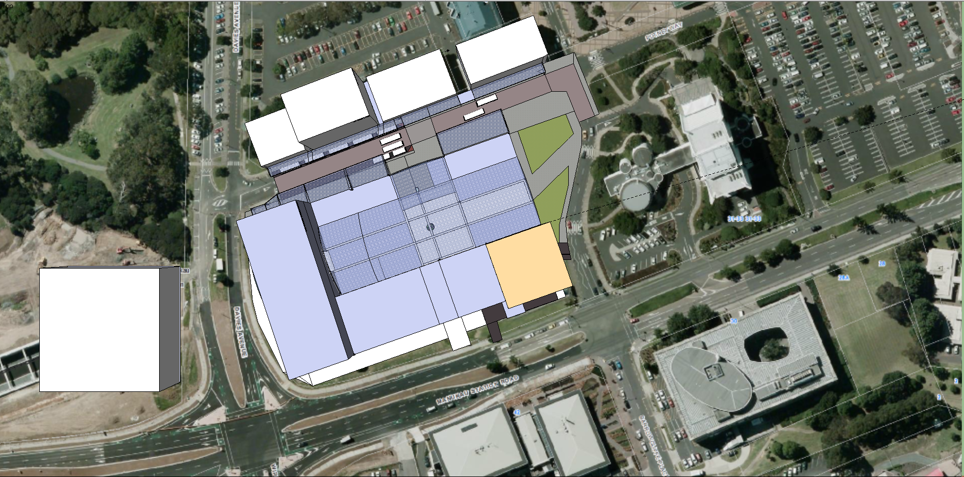
Once the concept drawings complete and finalised, they will be both uploaded into the computer and translated into Sketch Up for 3D mock-ups. Already one set of concepts have been translated into a full 3D mock-up – the Manukau Redevelopment MK3 which also incorporated Te Papa North into the complex (saving Hayman Park).
Manukau Redevelopment Concept
These two drawings (one the trace, the other the base) illustrates the wider Manukau area where I am focusing at the moment:
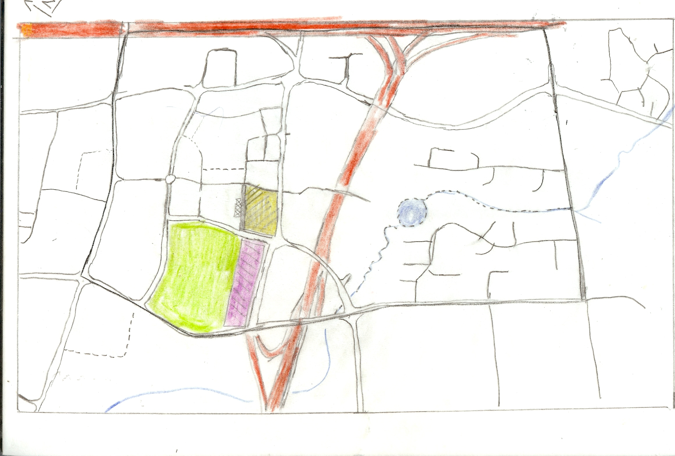
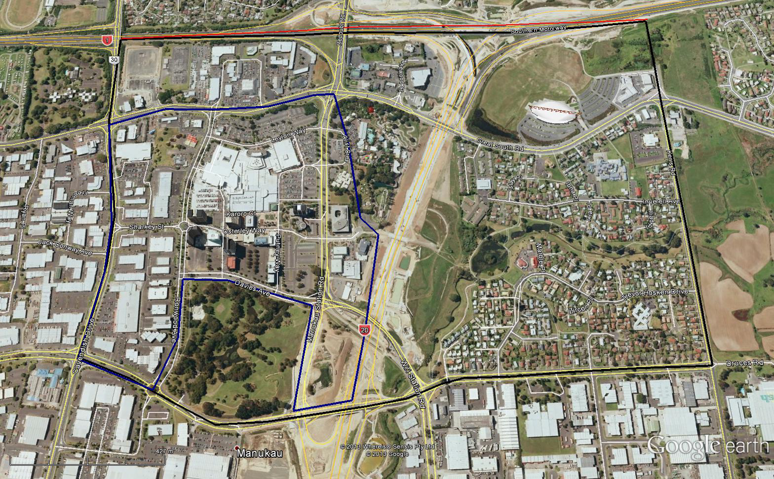
The black box shows the focus area of the wider Manukau Redevelopment while the dark blue box encompasses the Manukau Metropolitan Area (per the Unitary Plan). Both areas are two sub-projects to the redevelopment context
Manukau City Centre Redevelopment Concept
These two pictures showing the context work on the Manukau City Centre area – specifically around the Westfield Manukau Mall (the main focus point):

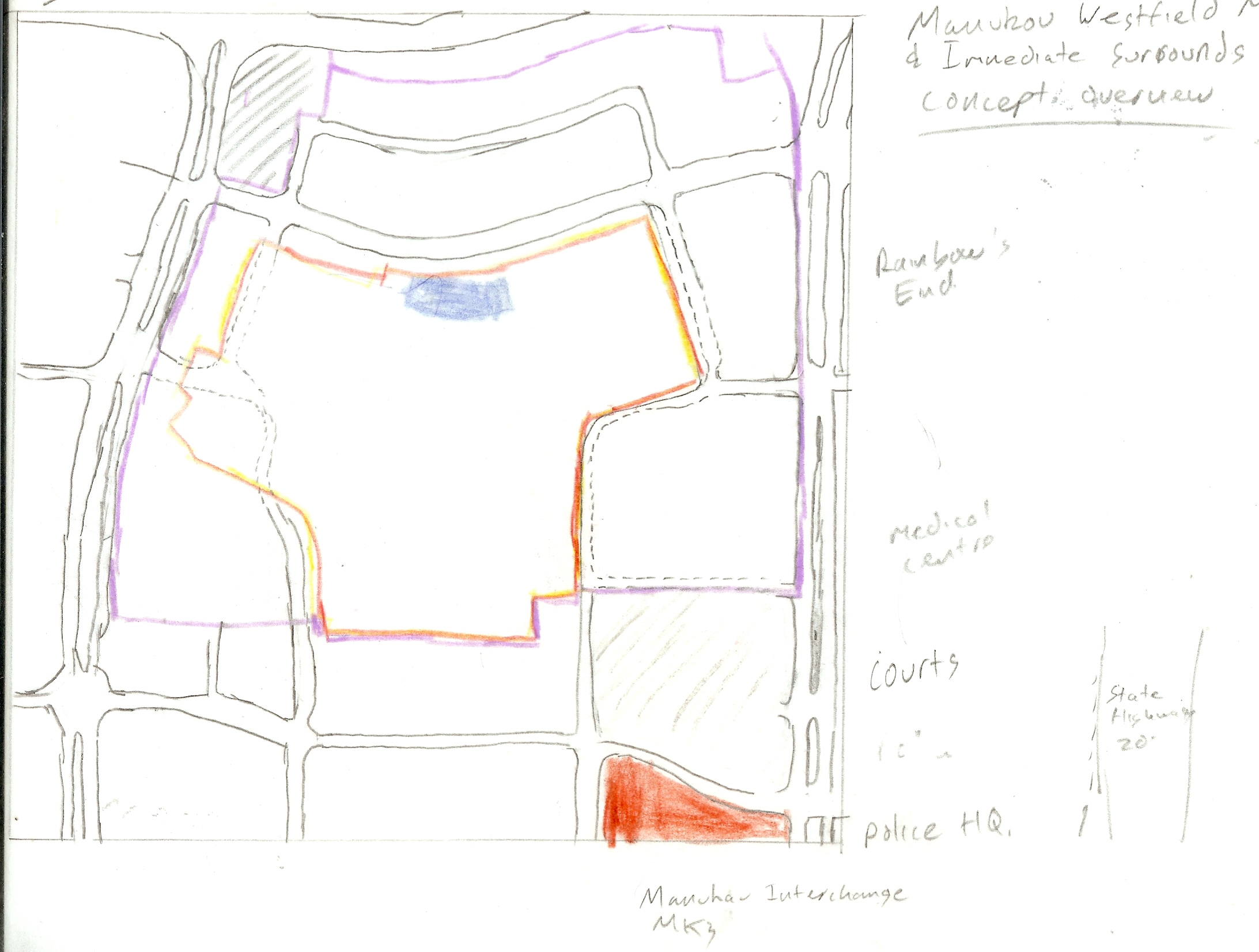
As was pointed out by Bryce yesterday in the comments department a major issue that will need to be addressed is connections around Manukau. Wide roads like: the Great South Road, Manukau Station Road, Cavendish Drive, Lambie Drive, Ronwood Avenue, and Davis Avenue (until the “upgrade” is complete by Auckland Transport) only reinforce the auto-dependent nature of the area and not particularly helpful to walkers. Trust me I did a circuit around the Manukau City Centre area by walking and it is not particularly easy.
However, these roads do have a natural advantage through their wide grass medians which allow tinkering around and improving the people connections.
The above “context” tracings (using the base photos as guides) will be used to draft up and illustrate key connections between various areas of Manukau into a unified urban fabric.
Gone should be the days cars segregated our urban spaces. Stitching the urban spaces back up is way back to the future. At the same time will linking the connections back up, contextual work is also being drawn up to get better use of Manukau’s land space. Too many surface car parks blighting the place, time to put them underground and have more productive urban “facilities” (including open spaces) over the top of them.
The inspiration coming from this:
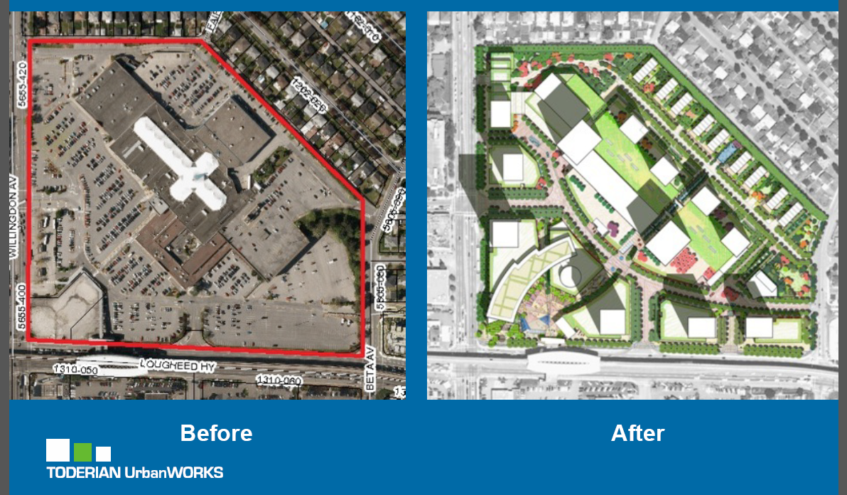
Reference and Credit to Toderian Urban Works
Something Manukau can inspire too (actually when this slide was shown at the presentation, we were all going MANUKAU!).
Because again and as Brent Toderian said: “battles will be won or lost in the suburbs.” And if the battle in suburbia South Auckland’s beating heart (Manukau) good luck trying to get both Area Plans and quality Urban Design and Renewal Projects) rolled out across the rest of a then suspicious Auckland.
Next post in the Manukau’s 21st Century Development (Part of the “Looking at Developing a 21st Century Auckland” Series) I will showcase work done on the stitching up the currently severed connections in Manukau linking the area into one unified urban fabric.
At the same time consider whether you would want a Vancouver Sky Train kind of concept linking Manukau up with Botany and Panmure to the east, and to the airport in the west. Or whether the Botany (heavy) Rail Line that was “scotched” in 2004 should be built going the same directions as the above mentioned Sky Train Concept would. If either concept gains traction I’ll have to “future” proof the mock-ups to allow such rail facilities. Don’t need to be retro-fitting in the future which is always expensive and a pain.
Tomorrow I will also be at the Unitary Plan open day at the Manukau Civic Centre rattling away with the planners all things Unitary Plan for the Southern Auckland area.
Must not forget to “stitch” this proposed redevelopment into the wider Manukau area…

