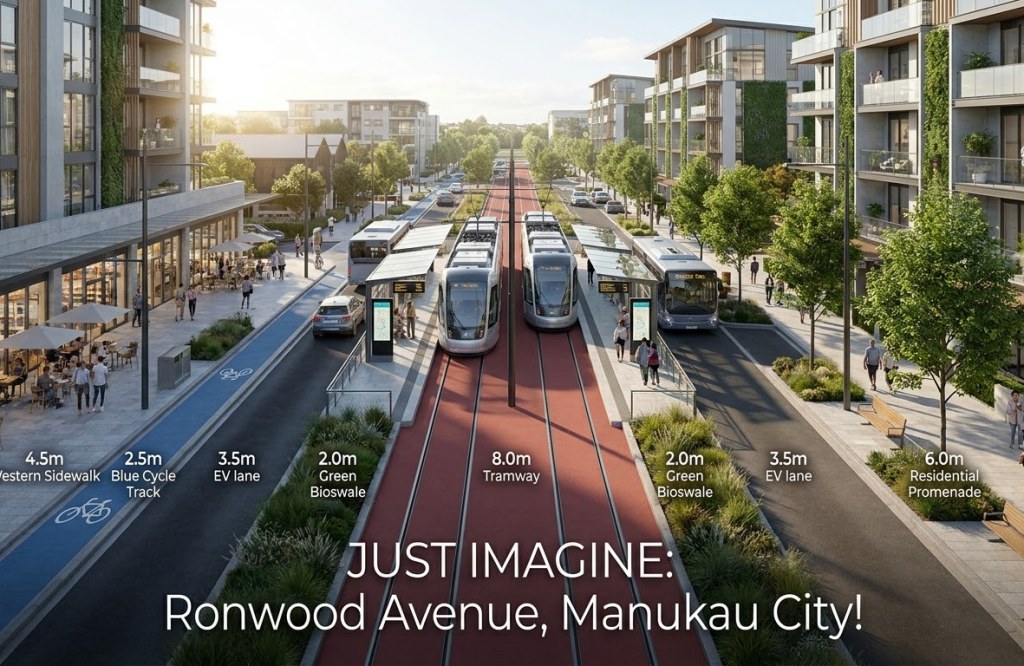
Let’s do this!
The Airport to Botany (A2B) Rapid Transit project is currently designated by Auckland Transport and Waka Kotahi NZTA as an 18km high-capacity Bus Rapid Transit (BRT) corridor. With route protection secured, Stage 1 completed at Puhinui Station, and Stage 2 upgrades along Te Irirangi Drive slated to begin in 2028, the corridor is designed to relieve regional congestion and link South and East Auckland.
But if Auckland is truly committed to Auckland Council’s Transform Manukau urban renewal program—transitioning Manukau City Centre from a car-dominated landscape into a walkable, high-density metropolitan core—we must ask a fundamental question: Is a busway enough to catalyse a multi-billion-dollar urban revolution?
The answer is no. If we want to build vibrant, legally resilient, and community-centric urban spaces, there must be advocate for the Airport to Botany corridor to be constructed as Light Rail Transit (LRT).
By taking the A2B corridor and upgrading it to a fully segregated central tramway, we can unlock the true potential of South Auckland’s premier metropolitan centre. To prove how this can be executed on the ground, Ben Ross has prototyped two key spatial concepts—Ronwood Avenue and Davis Avenue—using a Tri-Lens Model to show how light rail, high-density housing, and active urbanism co-exist.
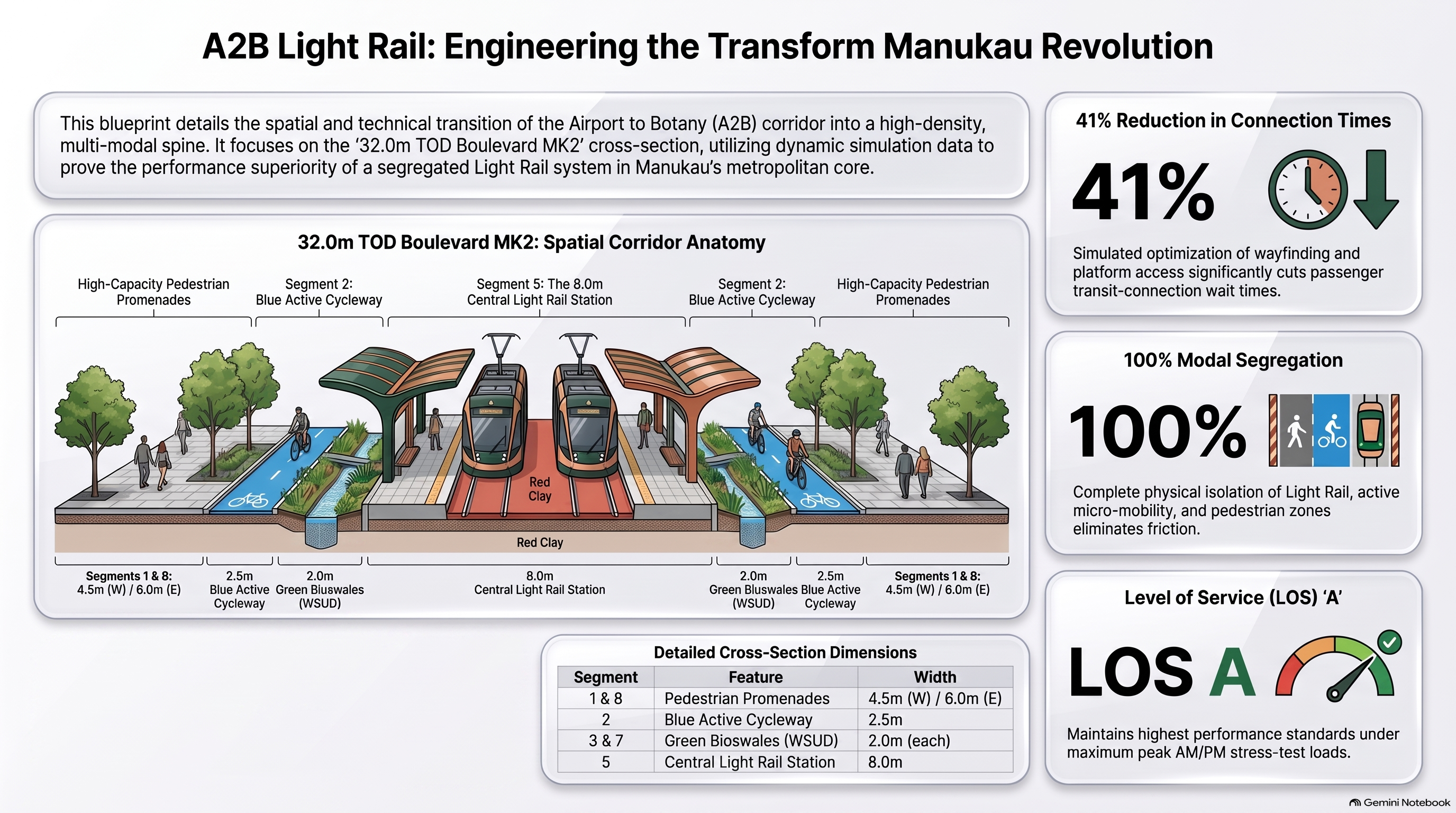
The Statutory Case for Light Rail: Solving the “Spatial Duality”
Under the Business – Metropolitan Centre Zone provisions of the Auckland Unitary Plan (AUP), Manukau Central is zoned for significant vertical intensification. However, traditional planning models suffer from a “Spatial Duality”—where macro-scale district plan compliance clashes with micro-scale pedestrian and transit behaviours on the ground. Dry 2D blueprints and static bus lanes fail to capture or guide human behaviour, leading to sterile public spaces and consenting delays during local hearings.
A dedicated, double-track 8.0m central light rail tramway acts as a permanent, high-capacity infrastructure anchor. It provides developers, local iwi, and international investors with the long-term certainty needed to build high-density Transit-Oriented Developments (TODs).
Through a Sim-to-Real spatial prototyping model that Ben is developing, Ben tested this central tramway configuration under maximum peak load, verifying that a light rail core can seamlessly move up to 15,000 passengers per hour while maintaining a Level of Service (LOS) “A” at critical access nodes.
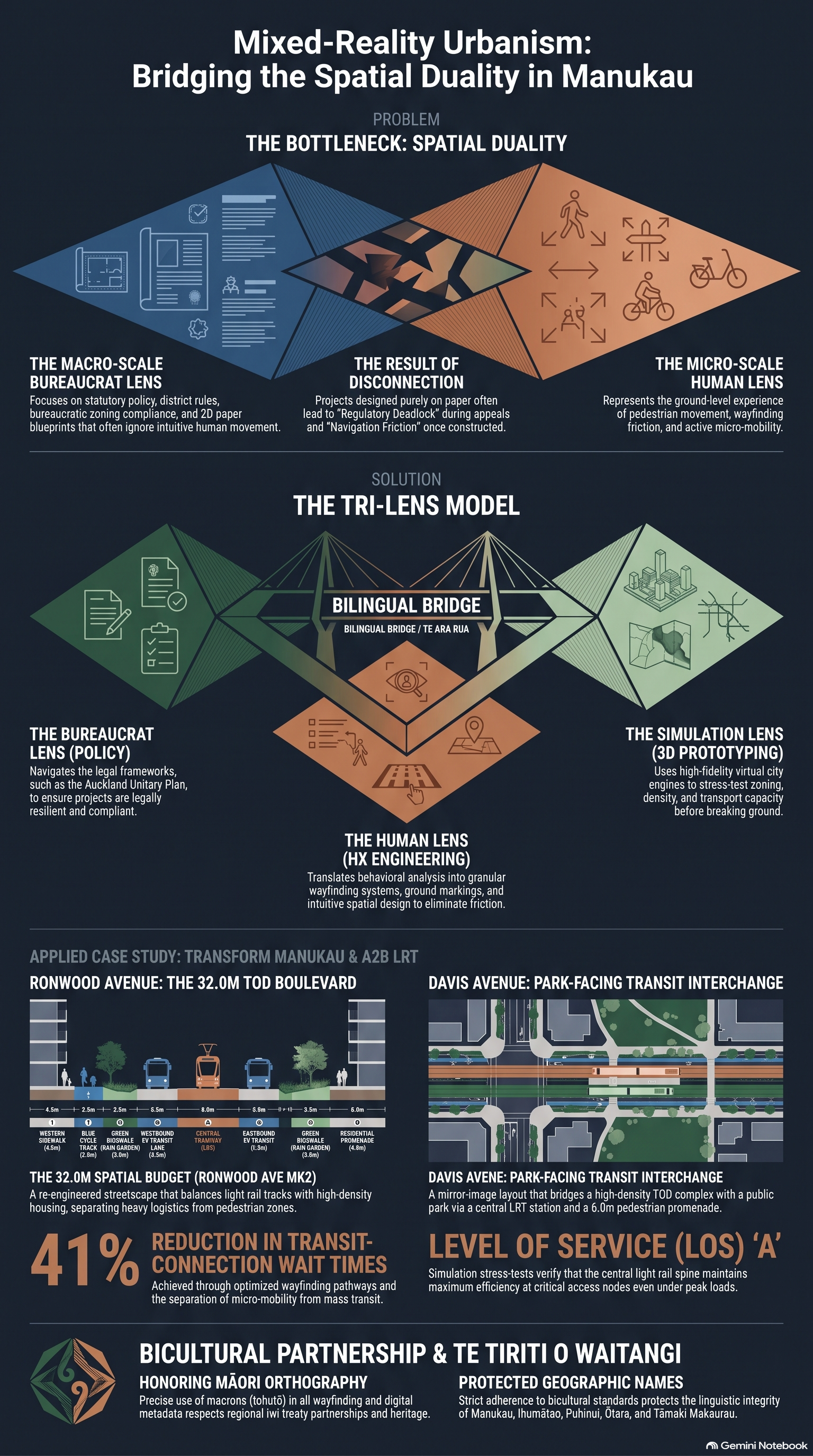
Concept 1: The Ronwood Avenue High-Density Superblock
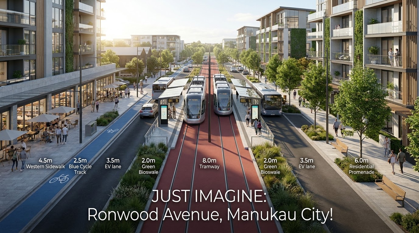
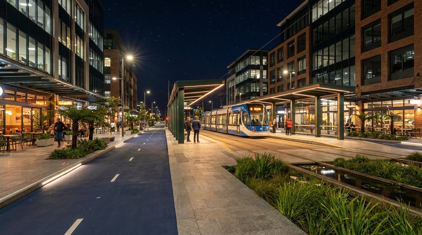
The proposed design for the 32.0m Ronwood Avenue TOD Boulevard MK2 illustrates how a central light rail spine can completely re-engineer a car-centric streetscape into a human-scale ecosystem.
Rather than forcing public transit, active micro-mobility, and freight to compete for residual road margins, the 32.0m spatial budget is divided into dedicated, structured segments:
- Segment 1 & 8: High-Capacity Sidewalks: Wide pedestrian margins (up to 6.0m on the eastern promenade) lined with premium granite pavers, native street trees, and outdoor dining. This satisfies the AUP’s active frontage requirements and shields local apartments from street noise.
- Segment 2: Segregated Active Cycleways: Continuous 2.5m cycle tracks physically buffered by low concrete planters, keeping micro-mobility completely isolated from general traffic.
- Segment 3 & 7: Green Bioswales (WSUD): Landscaped rain gardens utilizing native water-absorbing New Zealand sedges to capture and filter up to 90% of local storm runoff.
- Segment 4 & 6: Dedicated EV Transit Lanes: Single 3.5m lanes on each side, restricted exclusively to zero-emission bus loops and priority local deliveries.
- Segment 5: The central 8.0m Central Tramway Core: Isolating light rail movements from general traffic, eliminating lane-weaving friction and local bottleneck delays.
Digital simulations can simulate that this layout reduces passenger transit-connection wait times at the central platform, showing that separating even EV traffic from pedestrian zones maximizes safety, speed and comfort.
Concept 2: The Davies Avenue Park-Facing Transit Interchange
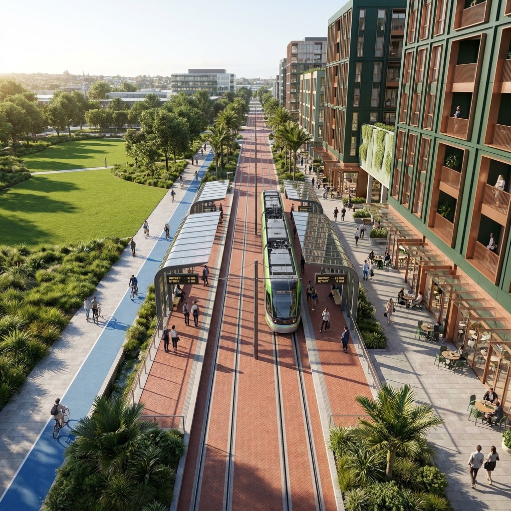
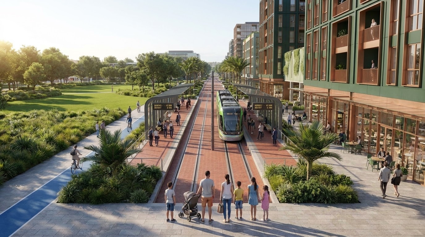
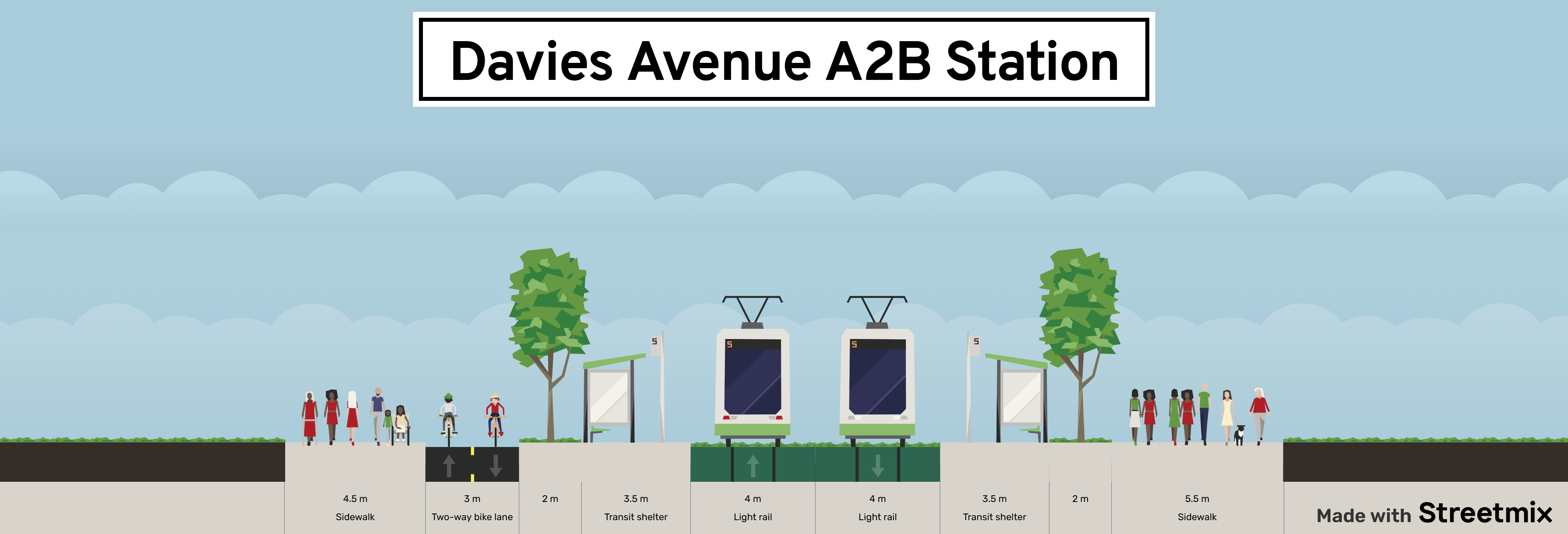
The spatial potential of light rail is even more evident along the Davies Avenue corridor. Here, the urban challenge is to bridge the gap between a large green public park on the western side of the street and high-density, mixed-use TOD complexes on the eastern side.
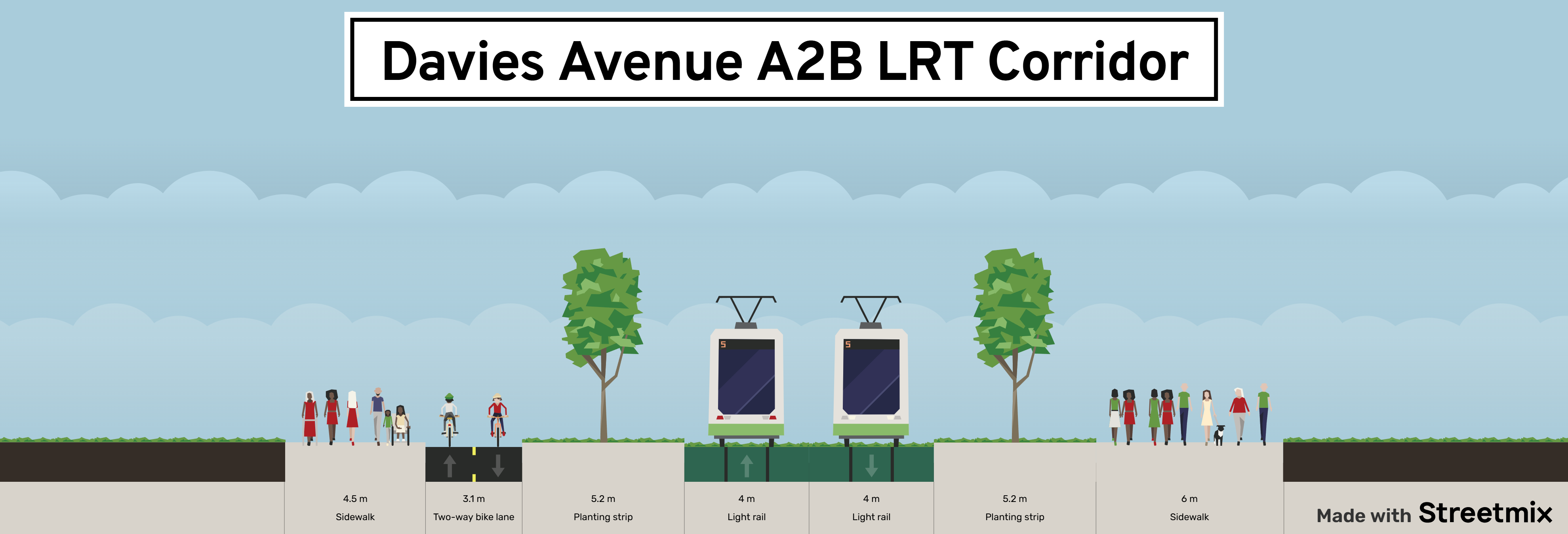
Using a 3D Wayfinding and Signage Placement Plan, Ben treat’s the western park margin as an active ecological and social asset. Davies Avenue’s 32.0-meter right-of-way is balanced as a mirror:
- The Western Park Promenade: Features a 4.5m wide premium sidewalk that blends seamlessly into the park, paired with a 2.5m blue cycle track and a 2.0m green bioswale to handle street-level runoff naturally.
- The Central LRT Station: A central double-track light rail platform paved in high-contrast red clay, featuring modern glass-and-steel transit shelters finished in matte Deep Forest Green and accented with Warm Copper structural trims.
- The Eastern TOD Promenade: A wide 6.0m pedestrian promenade directly fronting the retail storefronts, outdoor cafes, and residential lobbies of the multi-story towers.
By placing the high-capacity A2B Light Rail station in the centre of Davies Avenue, Ben minimises walking distances from both the eastern housing blocks and the western park. This design provides families and commuters with an incredibly intuitive, safe, and welcoming public interface.
Concept 3: Navigating the Transit Hub: The Supporting Wayfinding Package
Note: these AI wayfinding renderings are concepts only. These concepts would be sent to a human designer for full rendering and actual placements in the real world with their correct place name content.
For a Transit-Oriented Development to succeed, high-capacity infrastructure must be supported by intuitive, human-scale navigation systems that eliminate passenger transfer friction. A possible proposed wayfinding package is programmatically designed to guide users through the complex, multi-modal interchanges of Davis and Ronwood Avenues across a 24-hour cycle.
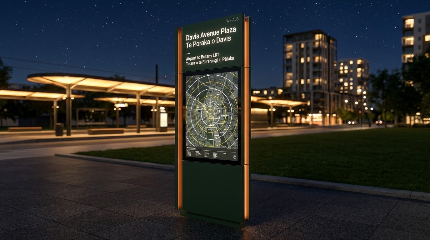
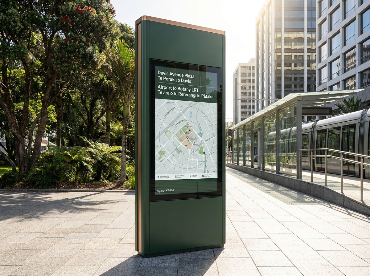
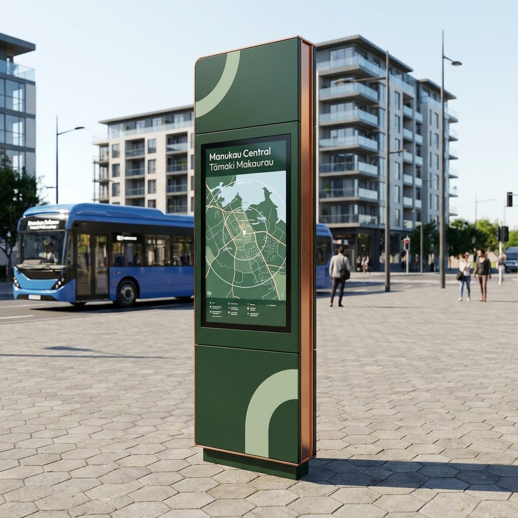
Type A: Monolithic Gateway Totem (Sign ID: WF-A03)
The primary gateway totem stands at 2.8 meters tall, acting as a highly visible social and navigation beacon. Constructed from a welded, marine-grade aluminum frame finished in matte Deep Forest Green and trimmed with polished Warm Copper, the structure features a dual day-to-night active face:
- Daytime Performance: Displays a clear, high-contrast georeferenced heads-up map and concentric 5-minute walking radius rings that help arriving rail passengers instantly orient themselves relative to the surrounding metropolitan superblock.
- Nighttime Performance: Under dark conditions, internal high-efficiency LED strips illuminate the totem’s anti-glare glass face from within. This ensures the map and walking rings remain completely legible while casting a warm, comforting glow on the promenade, enhancing public safety along the park edge.
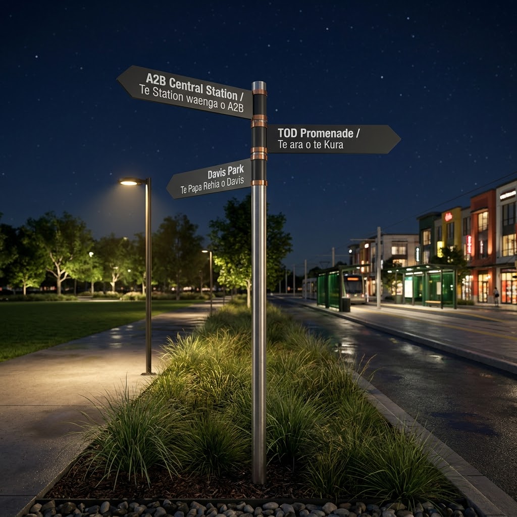
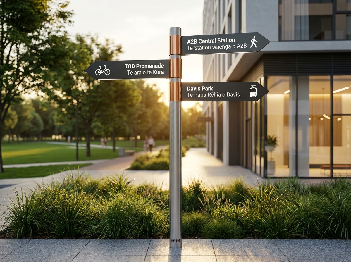
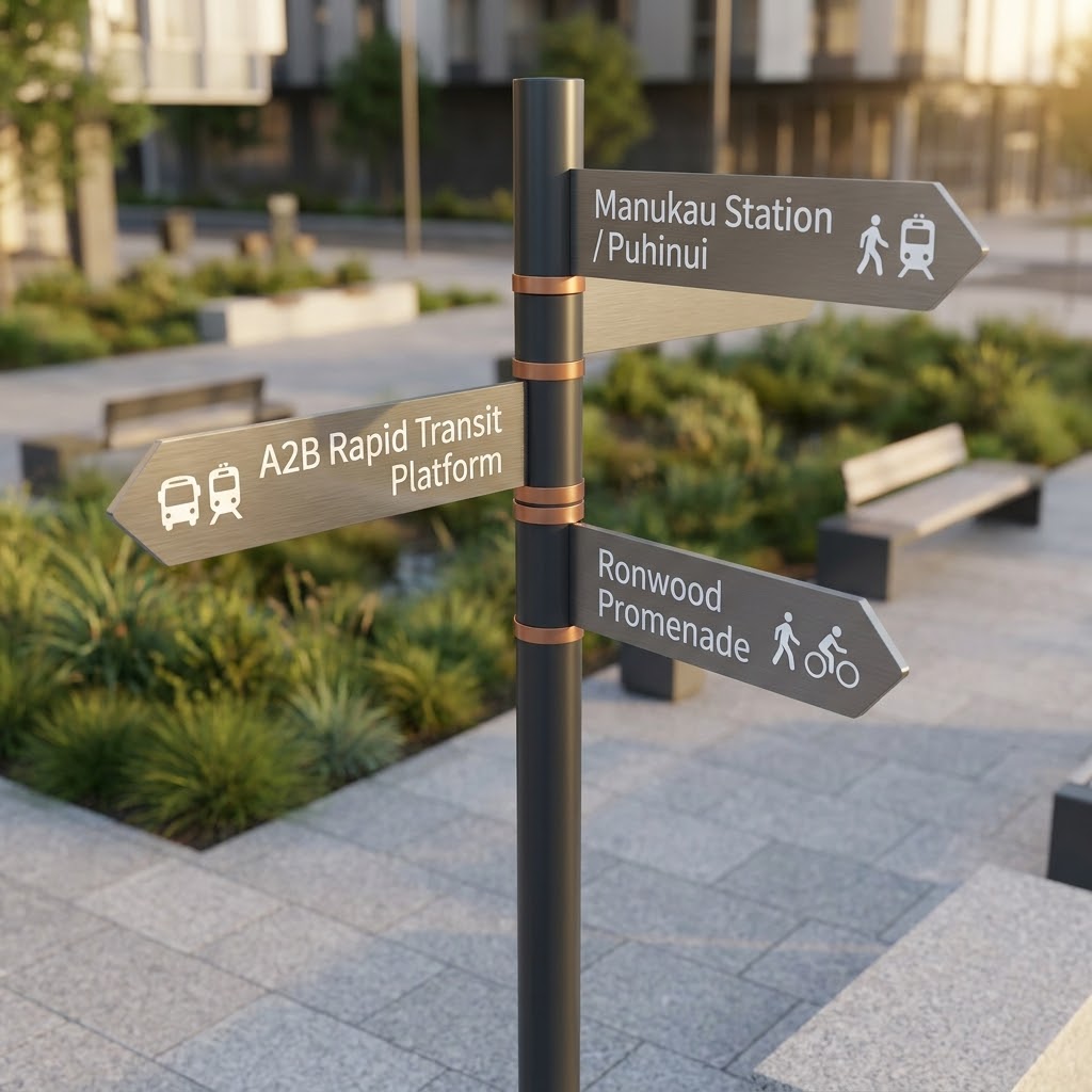
Type B: Pedestrian Directional Fingerpost (Sign ID: WF-B03)
Designed to guide foot traffic along the darker western margins and park connectors, the 2.4-meter-tall directional fingerposts utilize an innovative, unpowered reflective design:
- Daytime Performance: Features modular charcoal aluminum blades wrapped around a brushed Grade 316 marine-grade stainless steel mast, finished with distinct copper mechanical collar joints.
- Night-time Performance: To minimize grid-power consumption and protect the park’s natural ecological environment from light pollution, the directional text utilizes Class 400 retroreflective vinyl lettering. This film catches ambient lighting from street lamps and passing vehicles, glowing brightly to guide commuters to the Manukau Central Station, The Promenade, or Hayman Park without emitting active glare into the native tree canopy.
Other Wayfinding instruments
Type C: Integrated Ground Markings & Tactile Paving (Micro-Flow Safety)
Comprising continuous, high-visibility blue-painted cycle stencils along Segment 2 cycle lanes, yellow-ribbed directional tactile paving tiles at boarding points, and hazard-warning studs at platform edges. These physical interventions provide intuitive, non-verbal guidance for visually impaired commuters and structurally isolate active micro-mobility flows.

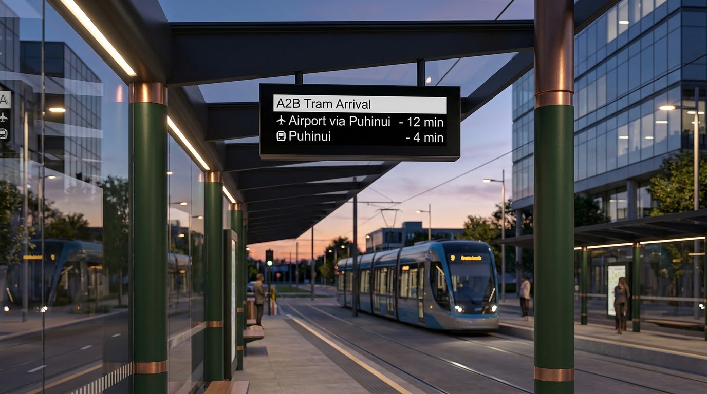
Type D: Real-Time Passenger Information (RTPI) Displays (Active Guidance)
Positioned directly underneath architectural transit shelters along the 8.0m Central Tramway. These digital, high-contrast, weatherproof e-paper displays provide active arrival countdowns, platform boarding safety notifications, and dynamic bilingual service updates, keeping transit movements highly predictable
Bicultural Safety & Treaty Alignment
This wayfinding package actively supports Auckland’s bicultural heritage under the principles of Te Tiriti o Waitangi (Treaty of Waitangi). Under our strict Bilingual Māori Orthography Policy, all physical signage, map files, and digital twin assets undergo rigorous linguistic auditing. This ensures 100% spelling precision and mandatory macrons to protect regional and ancestral place names, including: Manukau, Ihumātao, Puhinui, Ōtara, and Tāmaki Makaurau.
By reducing the cognitive load required to navigate high-volume transfers, this wayfinding package actively supports a possible simulated 41% reduction in connection wait times, proving that thoughtful micro-experience engineering is a vital pillar of transit success.
It’s Time for Auckland to Think Bigger
The designations for the Airport to Botany corridor are protected. While starting with Bus Rapid Transit provides a necessary early connection, the ultimate future of this corridor must be Light Rail.
As Auckland’s population grows, a standard busway will eventually hit its capacity ceiling. Light rail offers the permanent spatial infrastructure, the massive capacity (15,000+ passengers/hour), and the high-end aesthetic appeal required to transform South Auckland from a fragmented car-dependent landscape into a cohesive, walkable, and world-class metropolitan core.
We should not just design physical spaces; we MUST engineer the human experience within them. It’s time to build a transit corridor that Aucklanders can truly experience with pride.


